geocat.ch
Schutzbauten Zivilschutz
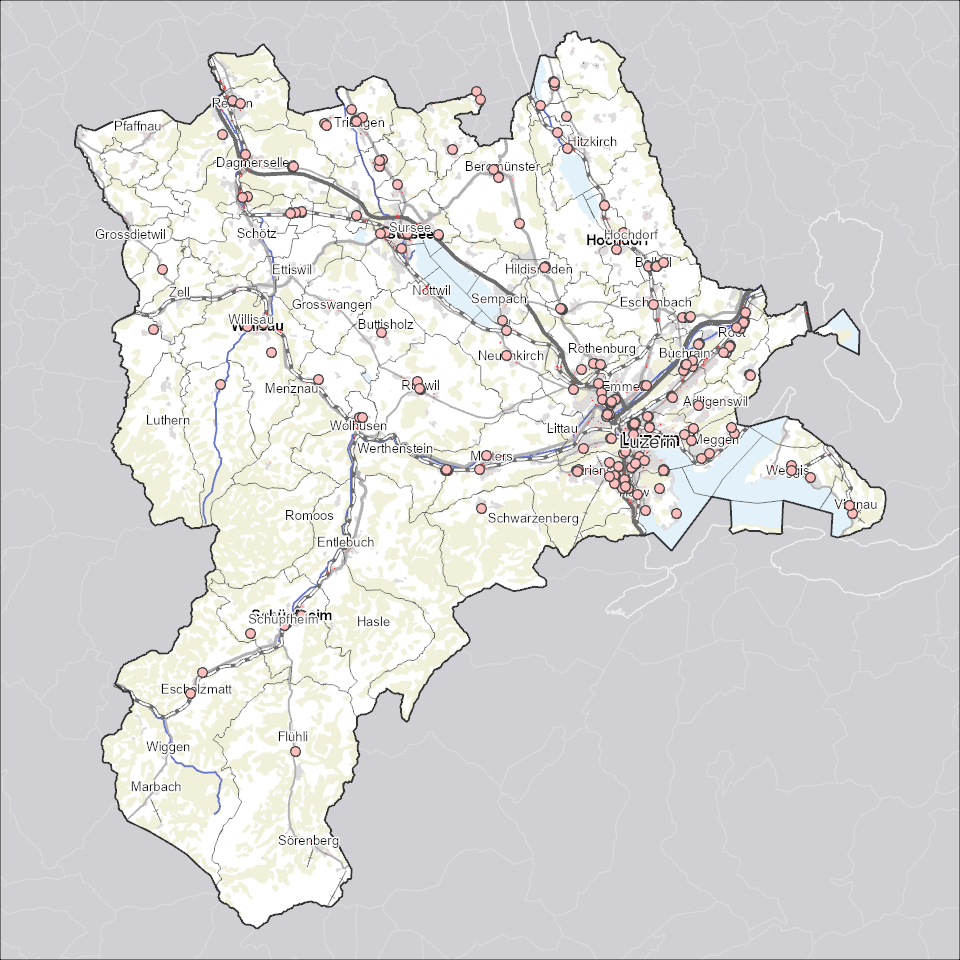
Aktive Schutzbauten des Zivilschutzes zur Unterbringung der Bevölkerung oder Kulturgütern im Ereignisfall. Dargestellt werden private und öffentliche Gebäude mit aktiven Schutzräumen oder Schutzanlagen. Schutzbauten, die nicht einem Gebäude zugeordnet werden können, sind als Punkt verortet.
Simple
Identification info
- Alternate title
-
LUFTSCHR_DS
- Date (Creation)
- 2025-10-22
- Presentation form
- Digital map
- Purpose
-
Die Schutzbauten dienen sowohl dem Bevölkerungs- als auch dem Kulturgüterschutz (KGS). Der Datensatz dient der Prüfung von Baugesuchen in Gebäuden mit aktiven Schutzbauten. Bauliche und technische Veränderungen an den Schutzräumen müssen der zuständigen Behörde zur Genehmigung eingereicht werden.
- Status
- On going
Point of contact
Responsible party
- Organisation name
-
Kanton Luzern, Abteilung Geoinformation
- Voice
-
041 228 51 83
Address
- City
-
Luzern
- Postal code
-
6002
- Country
-
CH
- Electronic mail address
- Streetname
-
Murbacherstrasse
- Streetnumber
-
21
- Website
- https://geoportal.lu.ch/ ( https )
- Role
- Publisher
Point of contact
Responsible party
- Organisation name
-
Dienststelle Militär, Zivilschutz und Justizvollzug, Zivilschutz
- Voice
-
041 317 44 11
Address
- City
-
Luzern
- Postal code
-
6000
- Country
-
CH
- Electronic mail address
- Streetname
-
Murmattweg
- Streetnumber
-
8
- Role
- Owner
- Last Name
-
Dienststelle Militär, Zivilschutz und Justizvollzug, Zivilschutz
- Organisation Acronym
-
mzj
- Maintenance and update frequency
- Continual
-
geocat.ch
-
-
opendata.swiss
-
Bevölkerung
-
Bewilligungen
-
Gebäude und Anlagen
-
Sicherheit
-
Zivilschutz
-
- Access constraints
- none
- Use constraints
- Copyright
- Use limitation
-
öffentlich zugängliche Geobasisdaten
- Access constraints
- none
- Use constraints
- none
- Use limitation
-
Freie Nutzung. Quellenangabe ist Pflicht
- Aggregate Datasetindentifier
- 0974a240-7c3d-42e0-9224-203c15a6d235
- Association Type
- Larger work citation
- Aggregate Datasetindentifier
- 863e369f-3dc5-4451-ae60-01b5ac818ffe
- Association Type
- Larger work citation
- Aggregate Datasetindentifier
- eb3b82b1-93d6-4bdb-9a83-5eab36266e9e
- Association Type
- Larger work citation
- Aggregate Datasetindentifier
- 91fd383f-343e-41f0-8c6d-b367bff1e131
- Association Type
- Larger work citation
- Spatial representation type
- Vector
- Language
- Deutsch
- Character set
- UTF8
- Topic category
-
- R Military, Security
- Description
-
Kanton Luzern
))
- Distribution format
-
-
ESRI Geodatabase (.gdb)
(
)
-
ESRI Shapefile (.shp)
(
)
-
OGC GeoPackage (.gpkg)
(
)
-
ESRI Geodatabase (.gdb)
(
)
Distributor contact
Responsible party
- Organisation name
-
Dienststelle Raum und Wirtschaft (rawi)
- Voice
-
041 228 51 83
Address
- City
-
Luzern
- Postal code
-
6002
- Country
-
CH
- Electronic mail address
- Streetname
-
Murbacherstrasse
- Streetnumber
-
21
- Website
- https://geoportal.lu.ch ( https )
- Role
- Point of contact
- First Name
-
Geodaten
- Last Name
-
Kanton Luzern
- Organisation Acronym
-
rawi
- OnLine resource
-
Datenshop
(
https
)
Produktansicht Geodatenshop
- Hierarchy level
- Dataset
- Statement
-
unbekannt
- Geometric object type
- polygon
- Reference system identifier
- CH1903+
Content Information
- Metadata language
-
ger
- Included with dataset
- Date (Publication)
- 2024-01-25
Class
- Name
-
Flächen
- Description
-
Schutzbauten Zivilschutz (Flächen)
Attribute
- Name
-
ADRESSE
- Description
-
Adresse
Attribute
- Name
-
EGID
- Description
-
Eidg. Gebäudeidentifikator
Attribute
- Name
-
KATEGORIE
- Description
-
Schutzraum Kategorie
Attribute
- Name
-
NUMMER
- Description
-
Nummer
Attribute
- Name
-
OBJECTID
- Description
-
OBJECTID
Attribute
- Name
-
PRZNUMMER
- Description
-
Parzellennummer
Attribute
- Name
-
QUALIFIKATION
- Description
-
Schutzraum Qualifikation
Attribute
- Name
-
Shape
- Description
-
Shape
Attribute
- Name
-
Shape_Area
- Description
-
Shape_Area
Attribute
- Name
-
Shape_Length
- Description
-
Shape_Length
Attribute
- Name
-
SRPLAETZE
- Description
-
Schutzraumplätze
- Model type
- Feature description
- Metadata language
-
ger
- Included with dataset
- Date (Publication)
- 2024-01-25
Class
- Name
-
Punkte
- Description
-
Schutzbauten Zivilschutz (Punkte)
Attribute
- Name
-
EGID
- Description
-
Eidg. Gebäudeidentifikator
Attribute
- Name
-
KATEGORIE
- Description
-
Schutzraum Kategorie
Attribute
- Name
-
NUMMER
- Description
-
Nummer
Attribute
- Name
-
OBJECTID
- Description
-
OBJECTID
Attribute
- Name
-
QUALIFIKATION
- Description
-
Schutzraum Qualifikation
Attribute
- Name
-
Shape
- Description
-
Shape
Attribute
- Name
-
SRPLAETZE
- Description
-
Schutzraumplätze
- Model type
- Feature description
Metadata
- Metadata language
- Deutsch
- Character set
- UTF8
- Hierarchy level
- Dataset
- Date stamp
- 2025-11-01
- Metadata standard name
-
GM03 2+
Metadata author
Responsible party
- Organisation name
-
Dienststelle Raum und Wirtschaft (rawi)
- Voice
-
041 228 51 83
Address
- City
-
Luzern
- Postal code
-
6002
- Country
-
CH
- Electronic mail address
- Streetname
-
Murbacherstrasse
- Streetnumber
-
21
- Website
- https://geoportal.lu.ch ( https )
- Role
- Point of contact
- First Name
-
Jaqueline
- Last Name
-
Boog
- Organisation Acronym
-
rawi
- Maintenance and update frequency
- As needed