geocat.ch
Inventaire cantonal des cours d'eau
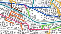
L'inventaire cantonal des cours d'eau représentent la position plus précise des cours d’eau en X et Y et leur typoplogie mais qui ne peut pas être utilisé comme un référenciel pour du référencement linéaire (sans données M et sans ID) . La topologie de ce réseau n’est pas non plus exploitable.
Simple
- Alternate title
-
Inventaire cantonal des cours d'eau
- Date (Creation)
- 2025-01-31
- Identifier
- 592
- Purpose
-
fournir une base de travail à l'administration cantonal pour définir l'inventaire cantonal des eaux superficielles publiques.
- Status
- Completed
Custodian
- Spatial representation type
- Vector
Spatial resolution
Equivalent scale
- Denominator
- 10000
- Topic category
-
- I Inland waters
Extent
Extent
- Description
-
Canton of Valais (VS)
))

- Maintenance and update frequency
- Irregular
Resource format
- Title
-
ESRI Enterprise Geodatabase
- Date
- Edition
-
-
- GEMET themes
-
-
water
-
- GEMET - INSPIRE themes, version 1.0
-
-
Hydrography
-
- GEMET concepts
-
-
cours d'eau
-
Resource constraints
- Use limitation
-
Aucunes
Resource constraints
- Access constraints
- Other restrictions
- Other constraints
-
Géodonnées accessibles au public (niveau A selon l'OGéo)
- Other constraints
-
Les conditions générales d'utilisation des géodonnées du Canton du Valais font foi ( https://www.vs.ch/fr/web/guest/information-legale).
- Language
- Français
- Character encoding
- UTF8
- Environment description
-
S:\Géodonnées VS\I Hydrographie\Inventaire valaisan des cours d'eau.lyrx
- Distribution format
-
-
ESRI File Geodatabase FileGDB (GDB)
-
ArcGIS REST Feature Service
-
Distributor
Digital transfer options
- OnLine resource
-
Géoportail du Canton du Valais
Géoportail du Canton du Valais
Digital transfer options
- OnLine resource
-
Localisation
Inventaire valaisan des cours d'eau
Digital transfer options
- OnLine resource
-
Type_cours_eau
Inventaire valaisan des cours d'eau
Digital transfer options
- OnLine resource
-
Inventaire_cantonal_eaux_publiques_superficielles
Inventaire valaisan des cours d'eau
Digital transfer options
- OnLine resource
-
Canaux
Inventaire valaisan des cours d'eau
Digital transfer options
- OnLine resource
-
Phenomenes_versant
Inventaire valaisan des cours d'eau
Digital transfer options
- OnLine resource
-
Nomenclature
Inventaire valaisan des cours d'eau
Digital transfer options
- OnLine resource
-
Plans_eau
Inventaire valaisan des cours d'eau
- Statement
-
Digitalisation des cours d'eau sur le plan d'ensemble ou mensuration officielle
- Hierarchy level
- Dataset
- Description
-
Digitalisation
Equivalent scale
- Denominator
- 10000
- Geometric object type
- Complex
- Geometric object count
- 30189
- Reference system identifier
- EPSG:2056/CH1903+_MN95
Metadata
- Metadata identifier
- 341191ee-d693-4c48-8018-72e0056780b8
- Language
- Français
- Character encoding
- UTF8
- Language
- Deutsch
- Character encoding
- UTF8
- Language
- Italiano
- Character encoding
- UTF8
- Language
- English
- Character encoding
- UTF8
- Language
- Rumantsch
- Character encoding
- UTF8
Distributor
Type of resource
- Resource scope
- Dataset
- Metadata linkage
-
https://www.geocat.ch/geonetwork/srv/api/records/341191ee-d693-4c48-8018-72e0056780b8
- Date info (Creation)
- 2025-07-04T09:26:41.536Z
- Date info (Revision)
- 2026-04-13T09:19:51.293549Z
Metadata standard
- Title
-
eCH-0271