geocat.ch
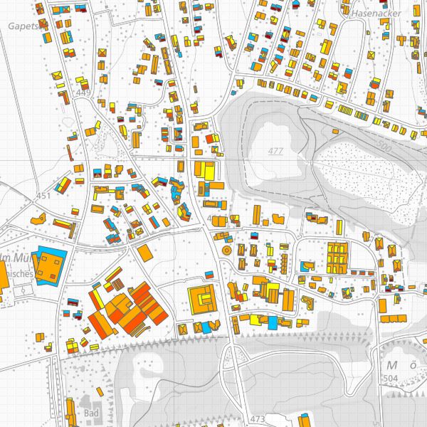
Eignung von Hausdächern für die Nutzung von Sonnenenergie
Die Sonnenenergie, welche auf die Erdoberfläche trifft, kann durch die beiden bewährten Solartechnologien Photovoltaik (Strom) und Solarthermie (Wärme) genutzt werden, um selber erneuerbare Energie zu produzieren. Das Potenzial von Solarstrom ist beträchtlich: bis zum Jahr 2050 könnten rund 20 Prozent des derzeitigen Strombedarfs in der Schweiz durch Photovoltaik erzeugt werden. Solarwärme ist dank standardisierten Anlagentypen für Warmwasser und Heizungsunterstützung eine interessante Option. Die Eignungskarte zeigt für ein Dach, wie gut es für die Nutzung von Solarenergie geeignet ist und welcher Ertrag möglich wäre. Dafür wird der Sonnengang über das Jahr simuliert und die auf jede Dachfläche treffende Sonnenstrahlung berechnet. Die Berechnungen basieren auf den Werten zur Sonneneinstrahlung des Bundesamtes für Meteorologie und Klimatologie (MeteoSchweiz) und den 3D-Gebäudedaten des Bundesamtes für Landestopografie swisstopo (Produkt swissBUILDINGS3D 2.0). Die Daten decken das ganze Fürstentum Liechtenstein ab.
Simple
-
Date (Publication)Data (Pubblicazione)Date (Publication)Datum (Publikation)
- 2016-12-13
-
IdentifiantIdentificatoreIdentifierKennung
- https://metadata.geo.llv.li/33e1d30d-efad-4530-b981-96e2fe97c820
-
ButScopoPurposeZweck
-
Solarkataster
-
ÉtatStatoStatusBearbeitungsstatus
-
RequisObbligatorioRequiredErforderlich
Point de contact
Punto di contatto
Point of contact
Ansprechpartner
-
Type de représentation spatialeTipo di rappresentazione spazialeSpatial representation typeRäumliche Darstellungsart
-
vecteurVettorialeVectorVektor
Résolution spatiale
Risoluzione spaziale
Spatial resolution
Räumliche Auflösung
Fraction représentative
Frazione rappresentativa
Equivalent scale
Vergleichsmassstab
-
DénominateurDenominatoreDenominatorMassstabszahl
- 25000
-
Catégorie de thèmeCategoria ISOTopic categoryThematik
-
-
Q Utilitaires de communicationQ Comunicazioni di pubblica utilitàQ Utilities communicationQ Ver- und Entsorgung, Kommunikation
-
K Climatologie, météorologie et atmosphèreclimatologyMeteorologyAtmosphereK Climatology, meteorology, atmosphereK Klimatologie, Meteorologie, Atmosphäre
-
Étendue
Estensione
Extent
Ausdehnung
Étendue
Estensione
Extent
Ausdehnung
-
DescriptionDescrizioneDescriptionBeschreibung
-
Liechtenstein
Liechtenstein
Liechtenstein
Liechtenstein
))

-
Fréquence de mise à jourFrequenza di aggiornamentoMaintenance and update frequencyWartungsintervall
-
Comme nécessaireSecondo necessitàAs neededBei Bedarf
- GEMET
-
-
énergie solaire
energia solare
solar energy
-
environnement
ambiente (in generale)
environment
-
- GEMET themes
-
-
énergie
energia
energy
-
Contraintes sur la ressource
Vincoli sulle risorse
Resource constraints
Ressourcenbeschränkungen
-
Limitation d'utilisationLimitazione d'usoUse limitationNutzungsbeschränkung
-
gebührenpflichtig
-
Contraintes d'accèsVincoli di accessoAccess constraintsZugriffsbeschränkungen
-
Autres restrictionsAltre restrizioniOther restrictionsAndere Beschränkungen
-
Autres contraintesAltri vincoliOther constraintsAndere Einschränkungen
-
-- URL Nutzungsbedingungen (s. Handbuch)
-
PaysPaeseCountryStaat
-
CHCHCHCH
-
TitreTitoloTitleTitel
-
510.620.2 Verordnung des VBS über die Gebühren des Bundesamtes für Landestopografie (GebV-swisstopo)
-
Date (Publication)Data (Pubblicazione)Date (Publication)Datum (Publikation)
- 2016-10-01
Ressource associée
Risorsa associata
Associated resource
Verlinkte Ressource
-
Type d'associationTipo di associazioneAssociation TypeAssoziationstyp
-
Citation de travail plus largeCitazione di un'opera più ampiaReference to a master resource of which this one is a partÜbergeordneter Datenbestand
-
Metadata ReferenceRiferimento metadatiMetadata ReferenceMetadatenreferenz
-
LangueLinguaLanguageSprache
- Deutsch
-
Encodage de caractèresCodifica dei caratteriCharacter encodingZeichenkodierung
-
Utf8UTF8UTF8Utf8
-
Catégorie de sous-thèmeCategoria di sottotemaSubtopic CategoryThematische Unterkategorien
-
Q1 ÉnergieQ1 EnergiaQ1 EnergyQ1 Energie
-
Format de distributionFormato (codifica)Distribution formatAbgabeformat
-
-
ESRI Shapefile (SHP)
-
Fournisseur
Fornitore di risorse
Resource provider
Anbieter
-
TitreTitoloTitleTitel
-
ESRI Shapefile (SHP)
-
DateDataDateDatum
Options de transfert numérique
Opzioni di trasferimento digitale
Digital transfer options
Optionen für die digitale Übertragung
-
Ressource en ligneRisorsa onlineOnLine resourceOnline
-
Bundeamt für Energie - Datenbezug
Options de transfert numérique
Opzioni di trasferimento digitale
Digital transfer options
Optionen für die digitale Übertragung
-
NiveauLivelloHierarchy levelBezugsebene
-
Jeu de donnéesSet di datiDatasetDatenbestand
-
Généralités sur la provenanceInformazioni generali sulla provenienzaStatementErklärung
-
-
-
NiveauLivelloHierarchy levelBezugsebene
-
Jeu de donnéesSet di datiDatasetDatenbestand
-
Niveau de topologieLivello di topologiaTopology levelTopologieebene
-
Topologie de réseau complèteGrafo planare completoFull planar graphVollständige Netzwerktopologie
-
Type d’objet géométriqueTipo di oggetto geometricoGeometric object typeTyp des geometrischen Objekts
-
PolygoneSuperficieSurfacesurface
-
Nombre d’objets géométriquesNumero di oggetti geometriciGeometric object countAnzahl geometrischer Objekte
- 1
-
Nom du système de référenceNome del sistema di riferimentoReference system identifierName des Referenzsystems
- http://www.opengis.net/def/crs/EPSG/0/2056
-
Fréquence de mise à jourFrequenza di aggiornamentoMaintenance and update frequencyWartungsintervall
-
Comme nécessaireSecondo necessitàAs neededBei Bedarf
Metadata
-
Identifiant des métadonnéesIdentificativo della schedaMetadata identifierIdentifikator des Metadatensatzes
- 33e1d30d-efad-4530-b981-96e2fe97c820
-
LangueLinguaLanguageSprache
- Deutsch
-
Encodage de caractèresCodifica dei caratteriCharacter encodingZeichenkodierung
-
Utf8UTF8UTF8Utf8
-
LangueLinguaLanguageSprache
- Français
-
Encodage de caractèresCodifica dei caratteriCharacter encodingZeichenkodierung
-
Utf8UTF8UTF8Utf8
-
LangueLinguaLanguageSprache
- Italiano
-
Encodage de caractèresCodifica dei caratteriCharacter encodingZeichenkodierung
-
Utf8UTF8UTF8Utf8
-
LangueLinguaLanguageSprache
- English
-
Encodage de caractèresCodifica dei caratteriCharacter encodingZeichenkodierung
-
Utf8UTF8UTF8Utf8
Point de contact
Punto di contatto
Point of contact
Ansprechpartner
Type de ressource
Tipo di risorsa
Type of resource
Anwendungsbereich der Metadaten
-
Domaine d'application de la ressourceAmbito di applicazione della risorsaResource scopeDomäne der Ressourcenanwendung
-
Jeu de donnéesSet di datiDatasetDatenbestand
-
Informations de date (Création)Informazioni sulla data (Creazione)Date info (Creation)Datumsangaben (Erstellung)
- 2016-12-13T09:57:45Z
-
Informations de date (Révision)Informazioni sulla data (Revisione)Date info (Revision)Datumsangaben (Aktualisierung)
- 2026-04-13T09:34:21.778066Z
Norme des métadonnées
Standard dei metadati
Metadata standard
Metadatenstandard
-
TitreTitoloTitleTitel
-
eCH-0271