 geocat.ch
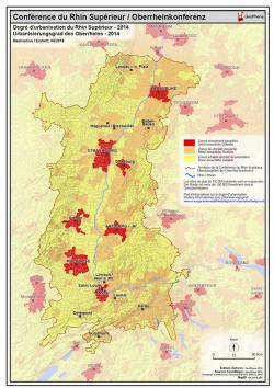
Degré d'urbanisation - 2014 PDF / Urbanisierungsgrad - 2014 PDF
Carte PDF du degré d'urbanisation du Rhin Supérieur en 2014
PDF Karte der Urbanisierungsgrad des Oberrheins - 2014
Simple
- Date (Creation)
- 2019-04-08
- Presentation form
- Hardcopy map
- Status
- Completed
- Topic category
-
- M Society
Extent
Extent
N
S
E
W
))
- Maintenance and update frequency
- Unknown
- Keywords
-
-
degré d'urbanisation; Rhin Supérieur; 2014; urbanisierungsgrad; Oberrheins; Karte
-
Resource constraints
- Use limitation
-
© OSM contributors GeoRhena 2019 - European Commission, Eurostat (ESTAT), GISCO, 2016
- Access constraints
- Copyright
- Use constraints
- Copyright
- Language
- Français
- Distribution format
-
-
PDF
-
Digital transfer options
- OnLine resource
-
Degré d'urbanisation - 2014 / Urbanisierungsgrad - 2014
Metadata
- Metadata identifier
- 33c2671f-2e10-4d1b-8c0f-c85f59e4d9b2
- Language
- Français
- Character encoding
- UTF8
Type of resource
- Resource scope
- staticMap
- Name
-
1
- Date info (Revision)
- 2025-06-18T15:23:04.126511Z
Metadata standard
- Title
-
ISO 19115-3:2018
- Edition
-
1.0
)))