geocat.ch
Erlebnis Geologie: Geowege
Géologie Vivante: Géo-sentiers
Avventura Geologia: Geo-sentieri
Experience Geology: Geo-trails
Aventura Geologia: Geo-sendas
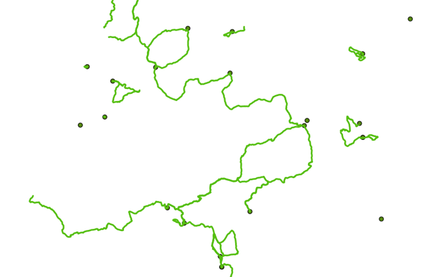
Geotourismus erschliesst erdgeschichtliche und landschaftliche Besonderheiten. Fachleute und Laien können auf geologischen Wanderwegen (Geowege) erdwissenschaftliche Entwicklungen vor Ort erleben und begreifen. Die Plattform Geowissenschaften der Akademie der Naturwissenschaften Schweiz (SCNAT) und «Erlebnis Geologie» haben die geologischen Wanderwege in der Schweiz zusammengestellt.
Le géotourisme met en valeur des particularités géologiques et paysagères. Les sentiers géologiques (Géo-sentiers) permettent à tout un chacun d’appréhender les processus géologiques et géomorphologiques sur le terrain. La Plate-forme Géosciences de l’Académie suisse des sciences naturelles (SCNAT) et « Géologie Vivante » ont compilé une liste des sentiers géologiques de Suisse.
Il geoturismo valorizza gli aspetti che raccontano la storia della Terra e del paesaggio mediante la realizzazione di carte, guide geologiche e sentieri geologici (Geo-sentieri). L’Accademia svizzera di scienze naturali (SCNAT) e “Avventura Geologia” hanno redatto un elenco di questi sentieri.
Geotourism valorizes special geological and landscape features. Geological hiking trails (Geo-trails), maps and guides are produced to make geology accessible to a broad audience. The Swiss Academy of Sciences (SCNAT) and “Erlebnis Geologie” have compiled a list of these trails.
Il geoturissem renda accessiblas particularitads geologicas e geomorfologicas. Sin sendas da viandar geologicas (Geo-sendas) pon laics sco era spezialists vesair e chapir svilups geologics al lieu. La plattafurma Geoscienzas da l'Academia svizra da las scienzas natiralas (SCNAT) ed «Aventura geologia» han cumpilà ina glista da las sendas da viandar geologicas.
Simple
-
Autre titreAltri nomi o acronimiAlternate titleAlternate titleAlternativtitel
-
Geowege
Géo-sentiers
Geo-sentieri
Geo-trails
Geo-sendas
-
Date (Dernière révision)Data (Ultima revisione)Date (Last Revision)Date (Last Revision)Datum (Letzte Überprüfung)
- 2020-03-11
-
IdentifiantIdentificatoreIdentifierIdentifierKennung
- ch.swisstopo.geologie-geowege
-
Forme de la présentationForma della presentazionePresentation formPresentation formPräsentationsform
-
Carte numériqueMappa digitaleDigital mapDigital mapDigitale Karte
-
ButScopoPurposePurposeZweck
-
Geologische Wanderwege der Schweiz
Sentiers géologiques de la Suisse
Point de contact
Punto di contatto
Point of contact
Point of contact
Ansprechpartner
Point de contact
Punto di contatto
Point of contact
Point of contact
Ansprechpartner
-
Type de représentation spatialeTipo di rappresentazione spazialeSpatial representation typeSpatial representation typeRäumliche Darstellungsart
-
vecteurVettorialeVectorVectorVektor
Résolution spatiale
Risoluzione spaziale
Spatial resolution
Spatial resolution
Räumliche Auflösung
Fraction représentative
Frazione rappresentativa
Equivalent scale
Equivalent scale
Vergleichsmassstab
-
DénominateurDenominatoreDenominatorDenominatorMassstabszahl
- 500000
-
Catégorie de thèmeCategoria ISOTopic categoryTopic categoryThematik
-
-
F Informations géoscientifiquesF Informazioni geoscientificheF Geoscientific informationF Geoscientific informationF Erdwissenschaften
-
Étendue
Estensione
Extent
Extent
Ausdehnung
Étendue
Estensione
Extent
Extent
Ausdehnung
-
DescriptionDescrizioneDescriptionDescriptionBeschreibung
-
Switzerland
Schweiz
Suisse
Svizzera
Svizra
))

-
Fréquence de mise à jourFrequenza di aggiornamentoMaintenance and update frequencyMaintenance and update frequencyWartungsintervall
-
InconnueSconosciutoUnknownUnknownUnbekannt
- GEMET - INSPIRE themes, version 1.0
-
-
Géologie
Geologia
Geology
-
- GEMET
-
-
sentier de randonnée
sentiero escursionistico
hiking trail
-
- GEMET themes
-
-
tourisme
turismo
tourism
-
- geocat.ch
-
-
BGDI Bundesgeodaten-Infrastruktur
IFDG l’Infrastructure Fédérale de données géographiques
IFDG Infrastruttura federale dei dati geografici
FSDI Federal Spatial Data Infrastructure
-
- GEMET
-
-
Landschaft
paysage
paesaggio
landscape
-
- geocat.ch
-
-
Natur
nature
natura
nature
-
-
LangueLinguaLanguageLanguageSprache
- Deutsch
-
Encodage de caractèresCodifica dei caratteriCharacter encodingCharacter encodingZeichenkodierung
-
Utf8UTF8UTF8UTF8Utf8
-
Catégorie de sous-thèmeCategoria di sottotemaSubtopic CategorySubtopic CategoryThematische Unterkategorien
-
F1 GéologieF1 GeologiaF1 GeologyF1 GeologyF1 Geologie
-
Format de distributionFormato (codifica)Distribution formatDistribution formatAbgabeformat
-
-
ESRI Shapefile (SHP)
-
Options de transfert numérique
Opzioni di trasferimento digitale
Digital transfer options
Digital transfer options
Optionen für die digitale Übertragung
-
Ressource en ligneRisorsa onlineOnLine resourceOnLine resourceOnline
-
Vorschau map.geo.admin.ch
Vorschau map.geo.admin.chAperçu map.geo.admin.chPrevisione map.geo.admin.chPreview map.geo.admin.ch
Options de transfert numérique
Opzioni di trasferimento digitale
Digital transfer options
Digital transfer options
Optionen für die digitale Übertragung
-
Ressource en ligneRisorsa onlineOnLine resourceOnLine resourceOnline
-
ch.swisstopo.geologie-geowege
WMS-BGDI Dienst, Layer "Geowege"Service WMS-IFDG, couche "Géo-sentiers"Servizio WMS-IFDG, strato "Geo-sentieri"WMS-FSDI service, layer "Geo-trails"WMS-BGDI Dienst, Layer "Geowege"
Options de transfert numérique
Opzioni di trasferimento digitale
Digital transfer options
Digital transfer options
Optionen für die digitale Übertragung
-
Ressource en ligneRisorsa onlineOnLine resourceOnLine resourceOnline
-
ch.swisstopo.geologie-geowege
WMTS-BGDI Dienst, Layer "Geowege"Service WMTS-IFDG, couche , Layer "Géo-sentiers"Servizio WMTS-IFDG, strato "Geo-sentieri"WMTS-FSDI service, layer "Geo-trails"WMTS-BGDI Dienst, Layer "Geowege"
Options de transfert numérique
Opzioni di trasferimento digitale
Digital transfer options
Digital transfer options
Optionen für die digitale Übertragung
-
Ressource en ligneRisorsa onlineOnLine resourceOnLine resourceOnline
-
Erlebnis Geologie
Options de transfert numérique
Opzioni di trasferimento digitale
Digital transfer options
Digital transfer options
Optionen für die digitale Übertragung
-
Ressource en ligneRisorsa onlineOnLine resourceOnLine resourceOnline
-
-
Options de transfert numérique
Opzioni di trasferimento digitale
Digital transfer options
Digital transfer options
Optionen für die digitale Übertragung
-
Ressource en ligneRisorsa onlineOnLine resourceOnLine resourceOnline
-
Geowege
Options de transfert numérique
Opzioni di trasferimento digitale
Digital transfer options
Digital transfer options
Optionen für die digitale Übertragung
-
Ressource en ligneRisorsa onlineOnLine resourceOnLine resourceOnline
-
Geologie-Portal: Geologische Wanderwege
Options de transfert numérique
Opzioni di trasferimento digitale
Digital transfer options
Digital transfer options
Optionen für die digitale Übertragung
-
Ressource en ligneRisorsa onlineOnLine resourceOnLine resourceOnline
-
RESTful API von geo.admin.ch
RESTful API von geo.admin.chRESTful API de geo.admin.chRESTful API da geo.admin.chRESTful API from geo.admin.chRESTful API dad geo.admin.ch
-
Nom du système de référenceNome del sistema di riferimentoReference system identifierReference system identifierName des Referenzsystems
- Referenzsystem entsprechend der zugrundeliegenden topographischen Karte (CH1903)
Metadata
-
Identifiant des métadonnéesIdentificativo della schedaMetadata identifierMetadata identifierIdentifikator des Metadatensatzes
- 3356602e-23d5-4e42-9d75-55fe9cc2daba
-
LangueLinguaLanguageLanguageSprache
- Deutsch
-
Encodage de caractèresCodifica dei caratteriCharacter encodingCharacter encodingZeichenkodierung
-
Utf8UTF8UTF8UTF8Utf8
-
LangueLinguaLanguageLanguageSprache
- Français
-
Encodage de caractèresCodifica dei caratteriCharacter encodingCharacter encodingZeichenkodierung
-
Utf8UTF8UTF8UTF8Utf8
-
LangueLinguaLanguageLanguageSprache
- Italiano
-
Encodage de caractèresCodifica dei caratteriCharacter encodingCharacter encodingZeichenkodierung
-
Utf8UTF8UTF8UTF8Utf8
-
LangueLinguaLanguageLanguageSprache
- English
-
Encodage de caractèresCodifica dei caratteriCharacter encodingCharacter encodingZeichenkodierung
-
Utf8UTF8UTF8UTF8Utf8
-
LangueLinguaLanguageLanguageSprache
- Rumantsch
-
Encodage de caractèresCodifica dei caratteriCharacter encodingCharacter encodingZeichenkodierung
-
Utf8UTF8UTF8UTF8Utf8
Point de contact
Punto di contatto
Point of contact
Point of contact
Ansprechpartner
Type de ressource
Tipo di risorsa
Type of resource
Type of resource
Anwendungsbereich der Metadaten
-
Domaine d'application de la ressourceAmbito di applicazione della risorsaResource scopeResource scopeDomäne der Ressourcenanwendung
-
Jeu de donnéesSet di datiDatasetDatasetDatenbestand
-
Lien vers la métadonnéeCollegamento ai metadatiMetadata linkageMetadata linkageLink zu den Metadaten
-
Informations de date (Création)Informazioni sulla data (Creazione)Date info (Creation)Date info (Creation)Datumsangaben (Erstellung)
- 2015-05-19T14:52:41Z
-
Informations de date (Révision)Informazioni sulla data (Revisione)Date info (Revision)Date info (Revision)Datumsangaben (Aktualisierung)
- 2026-04-13T09:41:45.279577Z
Norme des métadonnées
Standard dei metadati
Metadata standard
Metadata standard
Metadatenstandard
-
TitreTitoloTitleTitleTitel
-
eCH-0271