geocat.ch
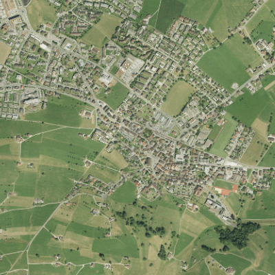
NW Orthofoto (kantonal) Siedlungsgebiet 2017
Der Geobasisdatensatz umfasst ein Luftbild des Kantons Nidwaldens, welches mit Hilfe eines Höhenmodells entzerrt und auf das Landeskoordinatensystem georeferenziert wurde. Das Bild wurde im Jahr 2017 mit der Auflösung von 10cm aufgenommen.
Simple
- Date (Creation)
- 2017-01-01
- Identifier
- 2017_NW_Siedlungsgebiet_10cm
- Status
- Completed
Owner
- Spatial representation type
- Grid
- Topic category
-
- A Imagery base maps earth cover
Extent
Extent
- Description
-
Canton of Nidwalden (NW)
N
S
E
W
))

- Maintenance and update frequency
- Not planned
- GEMET
-
-
aerial photograph
-
aerial photography
-
satellite image
-
- geocat.ch
-
-
orthophoto
-
settlement area
-
Resource constraints
- Access constraints
- Other restrictions
- Use constraints
- Other restrictions
- Other constraints
- Die Geodaten sind öffentlich zugänglich (Zugangsberechtigungsstufe A gemäss GeoIV Art. 21).
- Language
- Deutsch
- Character encoding
- UTF8
- Environment description
-
Extern
- Subtopic Category
- A3 Aerial and Satellite Imagery
- Basic Geodata
- false
- Distribution format
-
-
Tagged Image File Format (TIFF)
-
andere Formate auf Anfrage
-
Distributor
Digital transfer options
- OnLine resource
-
Webkarte Orthofoto 2016/17
Identifier
- Code
- 2056
Metadata
- Metadata identifier
- 30BD2971-B7D3-411D-B3A4-7DCBFD4B0B68
- Language
- Deutsch
- Character encoding
- UTF8
- Language
- Français
- Character encoding
- UTF8
- Language
- English
- Character encoding
- UTF8
- Language
- Italiano
- Character encoding
- UTF8
Custodian
Type of resource
- Resource scope
- Dataset
- Date info (Revision)
- 2026-05-12T10:10:46.000Z
Metadata standard
- Title
-
GM03_2