 geocat.ch
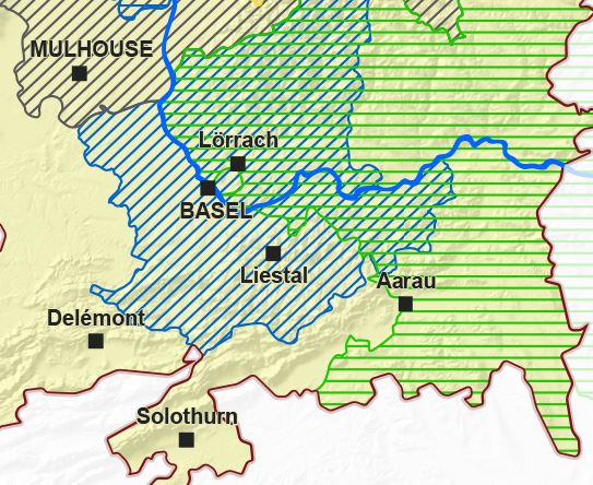
Cross-border cooperation territories
Cross-border cooperation territories - 2020
Simple
- Date (Creation)
- 2020-01-01
- Identifier
- GeoRhena_Territoires_Cooperation_ETRS89_01_2020
- Status
- On going
Point of contact
- mri:deliveryPoint
-
100, avenue d'Alsace
- mri:city
-
COLMAR
- mri:postalCode
-
68000
- Country
-
FRANCE
- Spatial representation type
- Vector
Spatial resolution
Equivalent scale
- Denominator
- 100000
- Topic category
-
- Q Utilities communication
Extent
Extent
Temporal extent
- Time period
- 2018-01-01 2021-12-31
Extent
Extent
N
S
E
W
))
- Maintenance and update frequency
- As needed
- Place
-
-
Rhin Supérieur / Oberrhein
-
- GEMET - Concepts, version 2.4
-
-
development plan
-
international co-operation
-
- GeoRhena
-
-
OpenData
-
Resource constraints
- Access constraints
- Other restrictions
- Use constraints
- Other restrictions
- Other constraints
-
© + OSM contributors - Ajoutez logo GeoRhena en cas de réutilisation / Das GeoRhena Logo verwenden für alle benutzung dieser Daten
- Language
- fre/deu
- Character encoding
- 8859 Part 1
- Distribution format
-
-
SHP GeoData
-
Digital transfer options
- OnLine resource
-
territoires_cooperation
Territoires de coopération du Rhin Supérieur
Digital transfer options
- OnLine resource
-
territoires_cooperation
Territoires de coopération du Rhin Supérieur
Digital transfer options
- OnLine resource
-
Téléchargement du Shapefile Téléchargement du Shapefile
- Statement
-
GeoRhena + OSM contributors
- Hierarchy level
- Dataset
- Reference system identifier
- EPSG/4258 / ETRS89
Metadata
- Metadata identifier
- 2e2ac169-2d73-4d49-ba37-46e5f2c1d860
- Language
- Français
- Character encoding
- UTF8
- Language
- Deutsch
- Character encoding
- UTF8
- Language
- English
- Character encoding
- UTF8
Contact
- mdb:deliveryPoint
-
100, avenue d'Alsace
- mdb:city
-
COLMAR
- mdb:postalCode
-
68000
- mdb:country
-
FRANCE
Type of resource
- Resource scope
- Dataset
- Date info (Revision)
- 2023-07-24T12:02:56.950737Z
Metadata standard
- Title
-
ISO 19115-3:2018
- Edition
-
1.0
)))