 geocat.ch
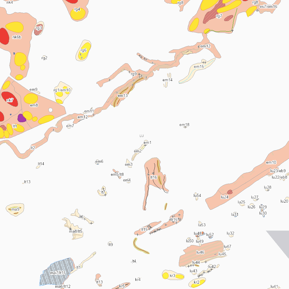
Lebensrauminventar (LRI): geologische und geomorphologische Elemente
Geologisch und geomorphologisch schützenswerte Elemente mit Schutzbedeutung national, regional und lokal
Simple
- Alternate title
-
LRIGEOXX_COL
- Date (Creation)
- 2023-03-02
- Presentation form
- Digital map
- Purpose
-
Der Kanton Luzern verfügt über ein Inventar der schützenswerten geologischen und geomorphologischen Elemente (Geotopinventar). Diese interessanten Zeugen der Zeit (z.B. Moränen, Toteislöcher, Drumlins oder Karstlandschaften) prägen die Landschaft und geben ihr ein unverwechselbares Aussehen. Zum Schutz der Einmaligkeit der Luzerner Landschaft hat der Regierungsrat 2001 das «Inventar der geologischen und geomorphologischen Elemente» erlassen. Der Regierungsrat hat das Inventar 2019 umfassend überprüft und revidiert. Neu umfasst es noch Elemente mit einer Gesamtfläche von rund 20'000 Hektar (bisher 65'000 Hektar). Das revidierte Inventar ist per 2. Juli 2019 in Kraft getreten.Das Inventar der geologisch und geomorphologisch schützenswerten Landschaften ist Bestandteil vom LRI (Lebensrauminventar). Unterschieden sind drei Schutztufen: national, regional und lokal.
- Status
- On going
Publisher
Owner
- Spatial representation type
- undefined
- Topic category
-
- L Environment
Extent
Extent
- Description
-
Kanton Luzern
))
- Maintenance and update frequency
- As needed
- geocat.ch
-
-
opendata.swiss
-
Geologie
-
Geomorphologie
-
Landschaftsschutz
-
Lebensraum
-
Naturschutz
-
Ökologische Vernetzung
-
Resource constraints
- Access constraints
- none
- Use constraints
- Copyright
Resource constraints
- Use limitation
-
öffentlich zugängliche Geobasisdaten
Resource constraints
- Access constraints
- none
- Use constraints
- none
Resource constraints
- Use limitation
-
Freie Nutzung. Quellenangabe ist Pflicht
Associated resource
- Association Type
- Reference to a master resource of which this one is a part
- Metadata Reference
Associated resource
- Association Type
- Reference to a master resource of which this one is a part
- Metadata Reference
- Distribution format
-
-
ESRI Geodatabase (.gdb)
-
ESRI Shapefile (.shp)
-
OGC GeoPackage (.gpkg)
-
Point of contact
Digital transfer options
- OnLine resource
-
Datenshop
Produktansicht Geodatenshop
- Statement
-
unbekannt
- Reference system identifier
- EPSG:2056
- Maintenance and update frequency
- As needed
Metadata
- Metadata identifier
- 2bfcb8cb-9334-448b-91d2-583fb2d93281
- Language
- Deutsch
- Character encoding
- UTF-8
Point of contact
Type of resource
- Resource scope
- Dataset
- Metadata linkage
-
https://www.geocat.ch/geonetwork/srv/api/records/2bfcb8cb-9334-448b-91d2-583fb2d93281
- Date info (Creation)
- 2020-01-22
- Date info (Revision)
- 2026-06-19T03:31:17.906733Z
Metadata standard
- Title
-
ISO19115.3-2018.che
)))