geocat.ch
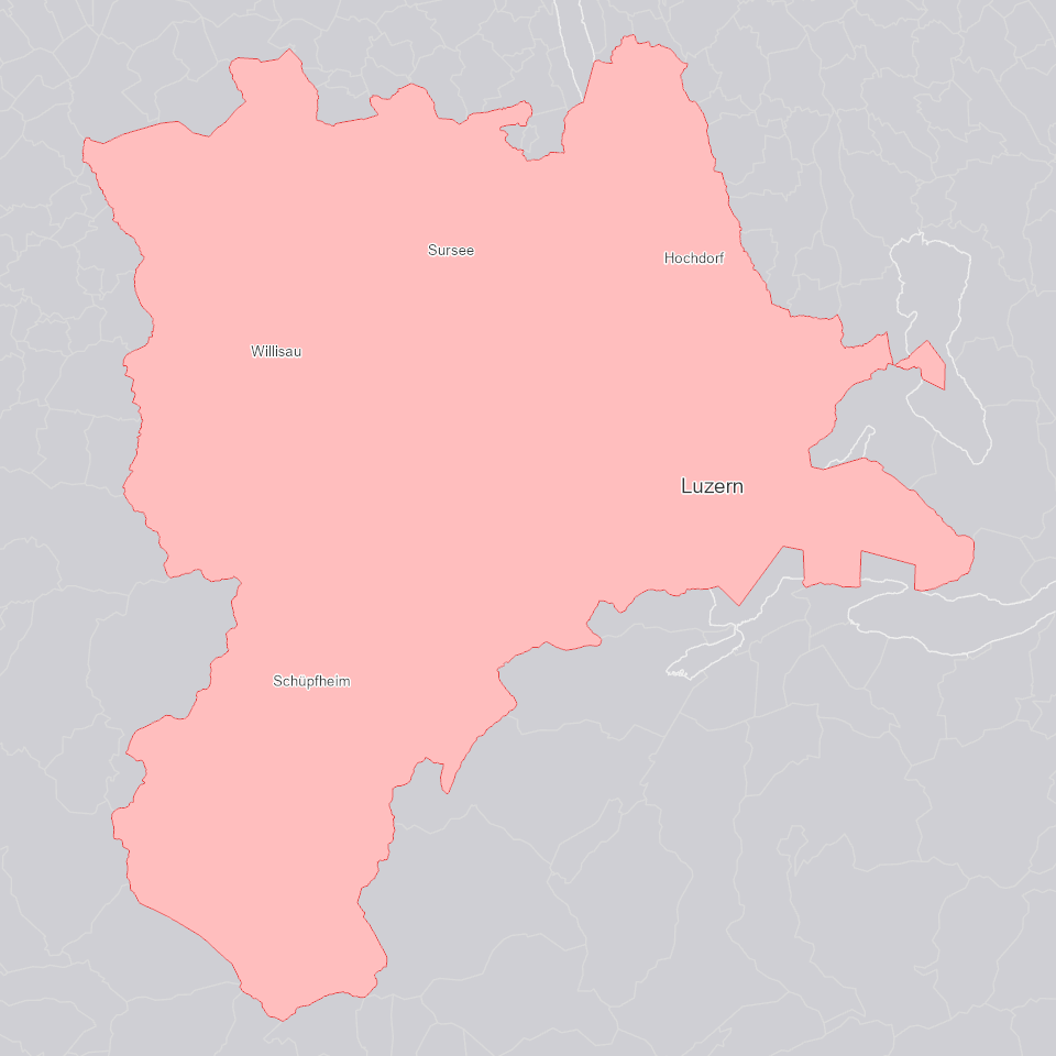
Kanton Luzern
Umriss des Kantons Luzern auf der Grundlage der AV Liegenschaften.
Simple
Informazioni di identificazione
- Titolo alternativo
-
GRZLUXXX_DS
- Data (Creazione)
- 2025-01-05
- Formato di presentazione
- Mappa digitale
- Finalità
-
Beinhaltet den Umriss des Kantons Luzern auf der Grundlage der AV Liegenschaften.
- Status
- In corso
Punto di contatto
Servizio responsabile
- Nome dell'ente
-
Kanton Luzern, Abteilung Geoinformation
- Telefono
-
041 228 51 83
Indirizzo
- Risorsa online
- https://geoportal.lu.ch/ ( https )
- Ruolo
- Publisher
Punto di contatto
Servizio responsabile
- Nome dell'ente
-
Dienststelle Raum und Wirtschaft (rawi)
- Telefono
-
041 228 51 83
Indirizzo
- Risorsa online
- https://geoportal.lu.ch ( https )
- Ruolo
- Owner
- Cognome
-
Dienststelle Raum und Wirtschaft (rawi)
- Abbreviazione dell'organizzazione
-
rawi
- Frequenza di aggiornamento
- Continuo
-
geocat.ch
-
-
opendata.swiss
-
Administrative Einteilung
-
Hoheitsgrenze
-
Referenzsystem
-
- Vincoli di accesso
- none
- Vincoli di fruibilità
- Proprietà intellettuale dei dati
- Limitazione d’uso
-
öffentlich zugängliche Geobasisdaten
- Vincoli di accesso
- none
- Vincoli di fruibilità
- none
- Limitazione d’uso
-
Freie Nutzung. Quellenangabe ist Pflicht
- Identificatore aggregato del dataset
- 92ccc24f-5bc7-4842-9059-6a3d329dd143
- Tipo di associazione
- Larger work citation
- Identificatore aggregato del dataset
- baaf6dc1-84e9-4ca8-a779-d0d5300416d9
- Tipo di associazione
- Larger work citation
- Identificatore aggregato del dataset
- c58020b9-2d6f-48ba-bb6b-721f7fcf04c1
- Tipo di associazione
- Larger work citation
- Identificatore aggregato del dataset
- f9e9bf99-2657-4ee5-9feb-1ee3d5b7d1df
- Tipo di associazione
- Larger work citation
- Identificatore aggregato del dataset
- 4f3d4a94-0560-4d54-94cc-ed5dcb333c9d
- Tipo di associazione
- Larger work citation
- Identificatore aggregato del dataset
- a57c40ea-b478-459e-815d-282270916aec
- Tipo di associazione
- Larger work citation
- Identificatore aggregato del dataset
- e3d58f9d-5b3e-401f-ac59-f1929f5175af
- Tipo di associazione
- Larger work citation
- Identificatore aggregato del dataset
- 22370b9f-bcf5-4b49-9f0e-eea770245a5a
- Tipo di associazione
- Larger work citation
- Identificatore aggregato del dataset
- 51128dd1-89c8-422a-bddf-9013a1246aae
- Tipo di associazione
- Larger work citation
- Identificatore aggregato del dataset
- 8b817bd9-8c7f-42e1-be73-e1069ae5871b
- Tipo di associazione
- Larger work citation
- Identificatore aggregato del dataset
- 2c412a31-e4b1-41ce-998f-9ef66487063b
- Tipo di associazione
- Larger work citation
- Identificatore aggregato del dataset
- 8879304d-d25c-4aa6-a16e-a2b5562d5845
- Tipo di associazione
- Larger work citation
- Identificatore aggregato del dataset
- 77b35779-4406-4f71-a307-6011ffb88f1e
- Tipo di associazione
- Larger work citation
- Identificatore aggregato del dataset
- 1efdb6da-6a13-4ba4-b680-e0c3a868250f
- Tipo di associazione
- Larger work citation
- Identificatore aggregato del dataset
- d80c23a0-a811-45c6-a71c-3ba80a418f8a
- Tipo di associazione
- Larger work citation
- Identificatore aggregato del dataset
- 83200fab-53ad-4cbc-bad2-0d072807cb42
- Tipo di associazione
- Larger work citation
- Identificatore aggregato del dataset
- f14ab16a-7809-4738-ad13-bfc84596fd14
- Tipo di associazione
- Larger work citation
- Identificatore aggregato del dataset
- 290cbcad-58a2-4944-aaf0-2678bb1cddc9
- Tipo di associazione
- Larger work citation
- Identificatore aggregato del dataset
- e2452fd1-510b-4997-ba90-9142741af7f8
- Tipo di associazione
- Larger work citation
- Identificatore aggregato del dataset
- 3a6c97c6-b26b-4e90-bfa2-eff62fc3ec6a
- Tipo di associazione
- Larger work citation
- Identificatore aggregato del dataset
- 1937899a-55f4-427d-85cd-c4fa7b23ef17
- Tipo di associazione
- Larger work citation
- Identificatore aggregato del dataset
- c319d6f1-ec3f-44f1-8d1e-ed37155be4c8
- Tipo di associazione
- Larger work citation
- Tipo di rappresentazione spaziale
- Dati vettoriali
- Lingua dei metadati
- Deutsch
- Set dei caratteri dei metadati
- UTF8
- Tema
-
- D Confini politici ed amministrativi
- Descrizione
-
Kanton Luzern
))
- Formato di distribuzione
-
-
ESRI Geodatabase (.gdb)
(
)
-
ESRI Shapefile (.shp)
(
)
-
OGC GeoPackage (.gpkg)
(
)
-
ESRI Geodatabase (.gdb)
(
)
Distributore
Servizio responsabile
- Nome dell'ente
-
Dienststelle Raum und Wirtschaft (rawi)
- Telefono
-
041 228 51 83
Indirizzo
- Risorsa online
- https://geoportal.lu.ch ( https )
- Ruolo
- Point of contact
- Nome
-
Geodaten
- Cognome
-
Kanton Luzern
- Abbreviazione dell'organizzazione
-
rawi
- Risorsa online
-
Datenshop
(
https
)
Produktansicht Geodatenshop
- Livello
- Set di dati
- Genealogia del dato – Processo di produzione
-
Abgeleitet von: GRZGBPER_V1_PY
- Genealogia del dato – Processo di produzione
-
Grundlagen: AV Liegenschaften
- Oggetto di tipo geometrico
- polygon
- Identificatore del sistema di riferimento
- CH1903+
Informazioni sul contenuto
- Lingua dei metadati
-
ger
- Included with dataset
- Data (Pubblicazione)
- 2017-06-19
Classe
- Designazione
-
Flächen
- Descrizione
-
Kanton Luzern
Attributo
- Nome
-
OBJECTID
- Descrizione
-
OBJECTID
Attributo
- Nome
-
SHAPE
- Descrizione
-
SHAPE
- Genere del modello
- Descrizione di oggetto
Metadata
- Lingua dei metadati
- Deutsch
- Set dei caratteri dei metadati
- UTF8
- Livello gerarchico
- Set di dati
- Data dei metadati
- 2025-09-03
- Nome dello Standard dei metadati
-
GM03 2+
Contatto
Servizio responsabile
- Nome dell'ente
-
Dienststelle Raum und Wirtschaft (rawi)
- Telefono
-
041 228 51 83
Indirizzo
- Città
-
Luzern
- Codice postale
-
6002
- Nazione
-
CH
- Via
-
Murbacherstrasse
- Numero
-
21
- Risorsa online
- https://geoportal.lu.ch ( https )
- Ruolo
- Point of contact
- Nome
-
Jonas
- Cognome
-
Thalmann
- Abbreviazione dell'organizzazione
-
rawi
- Frequenza di aggiornamento
- Non pianificato