geocat.ch
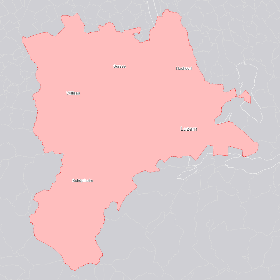
Kanton Luzern
Umriss des Kantons Luzern auf der Grundlage der AV Liegenschaften.
Simple
Identification info
- Alternate title
-
GRZLUXXX_DS
- Date (Creation)
- 2025-01-05
- Presentation form
- Digital map
- Purpose
-
Beinhaltet den Umriss des Kantons Luzern auf der Grundlage der AV Liegenschaften.
- Status
- On going
Point of contact
Responsible party
- Organisation name
-
Kanton Luzern, Abteilung Geoinformation
- Voice
-
041 228 51 83
Address
- City
-
Luzern
- Postal code
-
6002
- Country
-
CH
- Electronic mail address
- Streetname
-
Murbacherstrasse
- Streetnumber
-
21
- Website
- https://geoportal.lu.ch/ ( https )
- Role
- Publisher
Point of contact
Responsible party
- Organisation name
-
Dienststelle Raum und Wirtschaft (rawi)
- Voice
-
041 228 51 83
Address
- City
-
Luzern
- Postal code
-
6002
- Country
-
CH
- Electronic mail address
- Streetname
-
Murbacherstrasse
- Streetnumber
-
21
- Website
- https://geoportal.lu.ch ( https )
- Role
- Owner
- Last Name
-
Dienststelle Raum und Wirtschaft (rawi)
- Organisation Acronym
-
rawi
- Maintenance and update frequency
- Continual
-
geocat.ch
-
-
opendata.swiss
-
Administrative Einteilung
-
Hoheitsgrenze
-
Referenzsystem
-
- Access constraints
- none
- Use constraints
- Copyright
- Use limitation
-
öffentlich zugängliche Geobasisdaten
- Access constraints
- none
- Use constraints
- none
- Use limitation
-
Freie Nutzung. Quellenangabe ist Pflicht
- Aggregate Datasetindentifier
- 92ccc24f-5bc7-4842-9059-6a3d329dd143
- Association Type
- Larger work citation
- Aggregate Datasetindentifier
- baaf6dc1-84e9-4ca8-a779-d0d5300416d9
- Association Type
- Larger work citation
- Aggregate Datasetindentifier
- c58020b9-2d6f-48ba-bb6b-721f7fcf04c1
- Association Type
- Larger work citation
- Aggregate Datasetindentifier
- f9e9bf99-2657-4ee5-9feb-1ee3d5b7d1df
- Association Type
- Larger work citation
- Aggregate Datasetindentifier
- 4f3d4a94-0560-4d54-94cc-ed5dcb333c9d
- Association Type
- Larger work citation
- Aggregate Datasetindentifier
- a57c40ea-b478-459e-815d-282270916aec
- Association Type
- Larger work citation
- Aggregate Datasetindentifier
- e3d58f9d-5b3e-401f-ac59-f1929f5175af
- Association Type
- Larger work citation
- Aggregate Datasetindentifier
- 22370b9f-bcf5-4b49-9f0e-eea770245a5a
- Association Type
- Larger work citation
- Aggregate Datasetindentifier
- 51128dd1-89c8-422a-bddf-9013a1246aae
- Association Type
- Larger work citation
- Aggregate Datasetindentifier
- 8b817bd9-8c7f-42e1-be73-e1069ae5871b
- Association Type
- Larger work citation
- Aggregate Datasetindentifier
- 2c412a31-e4b1-41ce-998f-9ef66487063b
- Association Type
- Larger work citation
- Aggregate Datasetindentifier
- 8879304d-d25c-4aa6-a16e-a2b5562d5845
- Association Type
- Larger work citation
- Aggregate Datasetindentifier
- 77b35779-4406-4f71-a307-6011ffb88f1e
- Association Type
- Larger work citation
- Aggregate Datasetindentifier
- 1efdb6da-6a13-4ba4-b680-e0c3a868250f
- Association Type
- Larger work citation
- Aggregate Datasetindentifier
- d80c23a0-a811-45c6-a71c-3ba80a418f8a
- Association Type
- Larger work citation
- Aggregate Datasetindentifier
- 83200fab-53ad-4cbc-bad2-0d072807cb42
- Association Type
- Larger work citation
- Aggregate Datasetindentifier
- f14ab16a-7809-4738-ad13-bfc84596fd14
- Association Type
- Larger work citation
- Aggregate Datasetindentifier
- 290cbcad-58a2-4944-aaf0-2678bb1cddc9
- Association Type
- Larger work citation
- Aggregate Datasetindentifier
- e2452fd1-510b-4997-ba90-9142741af7f8
- Association Type
- Larger work citation
- Aggregate Datasetindentifier
- 3a6c97c6-b26b-4e90-bfa2-eff62fc3ec6a
- Association Type
- Larger work citation
- Aggregate Datasetindentifier
- 1937899a-55f4-427d-85cd-c4fa7b23ef17
- Association Type
- Larger work citation
- Aggregate Datasetindentifier
- c319d6f1-ec3f-44f1-8d1e-ed37155be4c8
- Association Type
- Larger work citation
- Spatial representation type
- Vector
- Language
- Deutsch
- Character set
- UTF8
- Topic category
-
- D Political and Administrative Boundaries
- Description
-
Kanton Luzern
))
- Distribution format
-
-
ESRI Geodatabase (.gdb)
(
)
-
ESRI Shapefile (.shp)
(
)
-
OGC GeoPackage (.gpkg)
(
)
-
ESRI Geodatabase (.gdb)
(
)
Distributor contact
Responsible party
- Organisation name
-
Dienststelle Raum und Wirtschaft (rawi)
- Voice
-
041 228 51 83
Address
- City
-
Luzern
- Postal code
-
6002
- Country
-
CH
- Electronic mail address
- Streetname
-
Murbacherstrasse
- Streetnumber
-
21
- Website
- https://geoportal.lu.ch ( https )
- Role
- Point of contact
- First Name
-
Geodaten
- Last Name
-
Kanton Luzern
- Organisation Acronym
-
rawi
- OnLine resource
-
Datenshop
(
https
)
Produktansicht Geodatenshop
- Hierarchy level
- Dataset
- Statement
-
Abgeleitet von: GRZGBPER_V1_PY
- Statement
-
Grundlagen: AV Liegenschaften
- Geometric object type
- polygon
- Reference system identifier
- CH1903+
Content Information
- Metadata language
-
ger
- Included with dataset
- Date (Publication)
- 2017-06-19
Class
- Name
-
Flächen
- Description
-
Kanton Luzern
Attribute
- Name
-
OBJECTID
- Description
-
OBJECTID
Attribute
- Name
-
SHAPE
- Description
-
SHAPE
- Model type
- Feature description
Metadata
- Metadata language
- Deutsch
- Character set
- UTF8
- Hierarchy level
- Dataset
- Date stamp
- 2025-09-03
- Metadata standard name
-
GM03 2+
Metadata author
Responsible party
- Organisation name
-
Dienststelle Raum und Wirtschaft (rawi)
- Voice
-
041 228 51 83
Address
- City
-
Luzern
- Postal code
-
6002
- Country
-
CH
- Electronic mail address
- Streetname
-
Murbacherstrasse
- Streetnumber
-
21
- Website
- https://geoportal.lu.ch ( https )
- Role
- Point of contact
- First Name
-
Jonas
- Last Name
-
Thalmann
- Organisation Acronym
-
rawi
- Maintenance and update frequency
- Not planned