 geocat.ch
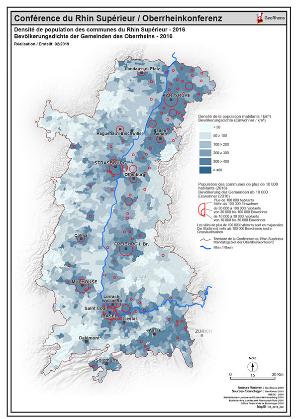
Densité de population 2016 PDF
Carte PDF de la densité de population communale du Rhin Supérieur au 01/01/2016
Simple
- Date (Creation)
- 2019-02-08
- Presentation form
- Hardcopy map
- Status
- Completed
- Topic category
-
- M Society
Extent
Extent
N
S
E
W
))
- Maintenance and update frequency
- Unknown
- Keywords
-
-
densité;population;PDF;carte;Karte;Rhin Supérieur;Rhin;Supérieur;2016;Bevölkerung;dichte;Bevölkerungsdichte;communale;Gemeinden
-
Resource constraints
- Use limitation
-
© OSM contributors - INSEE - STAL BW - STALA RP - OFS - GeoRhena
- Access constraints
- Copyright
- Use constraints
- Copyright
- Language
- Français
- Distribution format
-
-
PDF
-
PDF
-
Digital transfer options
- OnLine resource
- Ouvrir la carte statique PDF / Die PDF Karte öffnen
Metadata
- Metadata identifier
- 28cd0df7-2da0-47e7-8590-1025a4c63d71
- Language
- Français
- Character encoding
- UTF8
- Language
- Deutsch
- Character encoding
- UTF8
Type of resource
- Resource scope
- staticMap
- Name
-
1
- Date info (Revision)
- 2025-03-31T09:31:41.196428Z
Metadata standard
- Title
-
ISO 19115-3:2018
- Edition
-
1.0
)))