geocat.ch
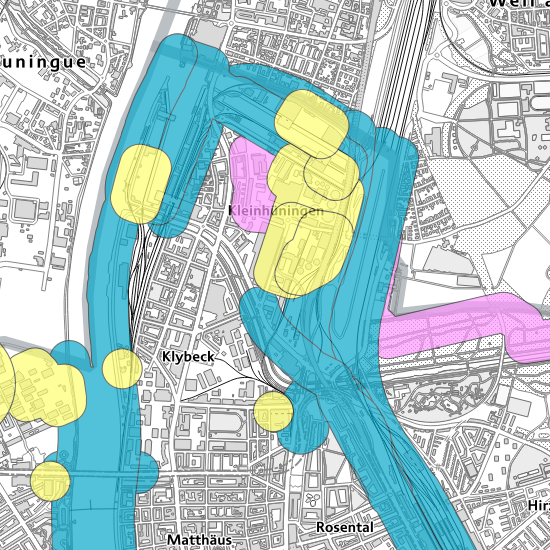
Konsultationsbereiche Störfallvorsorge
Angrenzende Bereiche um Betriebe, Verkehrswege und Rohrleitungsanlagen, die im Geltungsbereich der Störfallverordnung liegen, werden als Konsultationsbereiche bezeichnet. Diese Konsultationsbereiche dienen der Koordination der Raumplanung mit der Störfallvorsorge gemäss Art. 11a StFV und sind behördenverbindlich.
Simple
- Date (Creation)
- 2015-07-21
- Purpose
-
Die Konsultationsbereiche dienen der Koordination zwischen der Richt- und Nutzungsplanung und der Störfallvorsorge.
- Status
- Completed
Owner
- Hours of service
-
Mo - Fr: 8.00 - 11.45 und 13.30 - 17.00 Uhr (Fr - 16:00)
- Spatial representation type
- Vector
- Topic category
-
- L Environment
Extent
Extent
- Description
-
Canton of Basel-Stadt (BS)
))

- Maintenance and update frequency
- Irregular
- geocat.ch
-
-
major accident
-
- GEMET
-
-
physical planning
-
anticipation of danger
-
- geocat.ch
-
-
major accident
-
opendata.swiss
-
Resource constraints
- Other constraints
-
Die Geodaten sind öffentlich zugänglich. (Zugangsberechtigungsstufe [A] = öffentlich)
- Other constraints
-
Es gelten die Nutzungsbedingungen für Geodaten des Kantons Basel-Stadt. ( http://www.geo.bs.ch/agb)
Associated resource
- Title
-
Konsultationsbereiche Störfallvorsorge
- Association Type
- Reference to a master resource of which this one is a part
- Language
- Deutsch
- Character encoding
- UTF8
- Subtopic Category
- L1 Environmental Protection, Noise
- Basic Geodata
- true
- Basic Geodata ID
-
113>A
- Basic Geodata Legal Level
- Federal
- Basic Geodata Type
- openData
- Distribution format
-
-
ESRI Shapefile (SHP)
-
INTERLIS 2 (XTF)
-
ESRI File Geodatabase FileGDB (GDB)
-
OGC Geopackage (GPKG)
-
Distributor
- Hours of service
-
Mo - Do: 8:00 bis 12:00, 13:30 bis 16:30, Fr: 8:00 bis 12:00, 13:30 bis 16:00
Digital transfer options
- OnLine resource
-
MapBS
Öffentliches Auskunftssystem des Kantons Basel-Stadt
Digital transfer options
- OnLine resource
-
Geodaten-Shop
Öffentlich zugänglicher Geodaten-Downloaddienst des Kantons Basel-Stadt
Digital transfer options
- OnLine resource
-
WMS BS
Die derzeit im WMS BS verfügbaren Datenebenen entsprechen, bis auf wenige Ausnahmen, den Geodaten, welche auch in MapBS dargestellt sind. Der WMS BS ist kostenlos nutzbar und bietet Zugriff auf öffentliche sowie beschränkt öffentliche Geodaten, wobei gegebenenfalls Benutzername und Passwort benötigt werden (Zugangsdaten von MapBS).
Digital transfer options
- OnLine resource
-
WFS BS
Die derzeit im WFS BS verfügbaren Datenebenen entsprechen, bis auf wenige Ausnahmen, den Geodaten, welche auch in MapBS dargestellt sind. Der WFS BS ist kostenlos nutzbar und bietet Zugriff auf öffentliche sowie beschränkt öffentliche Geodaten, wobei gegebenenfalls Benutzername und Passwort benötigt werden (Zugangsdaten von MapBS).
Digital transfer options
- OnLine resource
-
Permalink opendata.swiss
Permalink opendata.swiss
- Reference system identifier
- CH1903+ / LV95/EPSG: 2056
Metadata
- Metadata identifier
- 26b74c06-a805-4600-91dc-1b680f34786f
- Language
- Deutsch
- Character encoding
- UTF8
- Language
- Français
- Character encoding
- UTF8
- Language
- Italiano
- Character encoding
- UTF8
- Language
- English
- Character encoding
- UTF8
Custodian
Type of resource
- Resource scope
- Dataset
- Metadata linkage
-
https://www.geocat.ch/geonetwork/srv/api/records/26b74c06-a805-4600-91dc-1b680f34786f
- Date info (Creation)
- 2015-07-31T14:03:24Z
- Date info (Revision)
- 2026-04-13T09:22:43.693493Z
Metadata standard
- Title
-
eCH-0271