geocat.ch
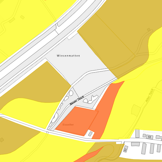
Bodenkarte
Die Bodenkarte zeigt die Boden- und Geländeeigenschaften von landwirtschaftlich genutzten Flächen in ihrer räumlichen Verbreitung, unter spezieller Berücksichtigung von Bodenwasserhaushalt und pflanzennutzbarer Gründigkeit. Sie ist Grundlage für die Beurteilung von Fragestellungen in den Bereichen Landwirtschaft, Raumplanung und Umweltschutz.
Simple
- Date (Creation)
- 2006-12-19
- Status
- Completed
Owner
- Hours of service
-
Mo - Fr: 8.00 - 12.00 und 14.00 - 17.00 Uhr
- Spatial representation type
- Vector
- Topic category
-
- F Geoscientific information
Extent
Extent
- Description
-
Canton of Basel-Stadt (BS)
))

- Maintenance and update frequency
- Not planned
- geocat.ch
-
-
opendata.swiss
-
Resource constraints
- Other constraints
-
Die Geodaten sind öffentlich zugänglich. (Zugangsberechtigungsstufe [A] = öffentlich)
- Other constraints
-
Es gelten die Nutzungsbedingungen für Geodaten des Kantons Basel-Stadt. ( http://www.geo.bs.ch/agb)
Associated resource
- Title
-
Bodenkarte
- Association Type
- Reference to a master resource of which this one is a part
- Language
- Deutsch
- Character encoding
- UTF8
- Subtopic Category
- F1 Geology
- Subtopic Category
- F2 Soils
- Basic Geodata
- true
- Basic Geodata ID
-
125
- Basic Geodata Legal Level
- Federal
- Basic Geodata Type
- openData
- Distribution format
-
-
ESRI Shapefile (SHP)
-
INTERLIS 1 (ITF)
-
Distributor
- Hours of service
-
Mo - Do: 8:00 bis 12:00, 13:30 bis 16:30, Fr: 8:00 bis 12:00, 13:30 bis 16:00
Digital transfer options
- OnLine resource
-
MapBS
Öffentliches Auskunftssystem des Kantons Basel-Stadt
Digital transfer options
- OnLine resource
-
Geodaten-Shop
Öffentlich zugänglicher Geodaten-Downloaddienst des Kantons Basel-Stadt
Digital transfer options
- OnLine resource
-
WMS BS
Die derzeit im WMS BS verfügbaren Datenebenen entsprechen, bis auf wenige Ausnahmen, den Geodaten, welche auch in MapBS dargestellt sind. Der WMS BS ist kostenlos nutzbar und bietet Zugriff auf öffentliche sowie beschränkt öffentliche Geodaten, wobei gegebenenfalls Benutzername und Passwort benötigt werden (Zugangsdaten von MapBS).
Digital transfer options
- OnLine resource
-
WFS BS
Die derzeit im WFS BS verfügbaren Datenebenen entsprechen, bis auf wenige Ausnahmen, den Geodaten, welche auch in MapBS dargestellt sind. Der WFS BS ist kostenlos nutzbar und bietet Zugriff auf öffentliche sowie beschränkt öffentliche Geodaten, wobei gegebenenfalls Benutzername und Passwort benötigt werden (Zugangsdaten von MapBS).
Digital transfer options
- OnLine resource
-
Permalink opendata.swiss
Permalink opendata.swiss
- Reference system identifier
- CH1903+ / LV95/EPSG: 2056
Metadata
- Metadata identifier
- 23a0f31d-c844-4a1d-8403-adc134f5977b
- Language
- Deutsch
- Character encoding
- UTF8
- Language
- Français
- Character encoding
- UTF8
- Language
- Italiano
- Character encoding
- UTF8
- Language
- English
- Character encoding
- UTF8
Custodian
Type of resource
- Resource scope
- Dataset
- Metadata linkage
-
https://www.geocat.ch/geonetwork/srv/api/records/23a0f31d-c844-4a1d-8403-adc134f5977b
- Date info (Creation)
- 2012-02-20T15:21:04Z
- Date info (Revision)
- 2026-04-13T09:42:31.751091Z
Metadata standard
- Title
-
eCH-0271