 geocat.ch
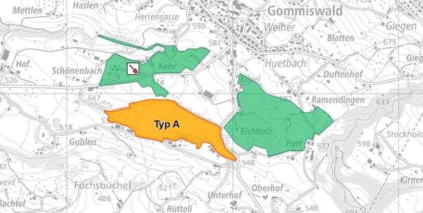
Abbaustellen und Deponien
Abbaustellen und Deponien. Umgrenzung der bewilligten Abbau- und Deponiepläne. Darstellung der Deponien nach Typ:
-Typ A: unverschmutzter Aushub
-Typ B: Inertstoffdeponie
-Typ D: Schlackendeponie
-Typ E: Reaktordeponie
Simple
- Date (Creation)
- 2017-07-12
- Date (Revision)
- 2026-06-21
- Other citation details
-
Wasser- und Abfallsysteme
- Purpose
-
-
- Status
- On going
partner
Amt für Raumentwicklung und Geoinformation - geodaten@sg.ch
Lämmlisbrunnenstrasse 54
St. Gallen
9001
CH
Homepage
- Hours of service
-
Mo. - Fr. von 8:00 - 17:00 Uhr
- Spatial representation type
- Vector
Spatial resolution
- Spatial resolution
- 1 m
Extent
Extent
- Description
-
Kanton St.Gallen
N
S
E
W
))
- Maintenance and update frequency
- Irregular
- geocat.ch
-
-
Abbaustellen
-
opendata.swiss
-
- GEMET
-
-
Deponie
-
Resource constraints
- Access constraints
- Other restrictions
- Other constraints
-
A = öffentlich
Resource constraints
- Classification
- Unclassified
- Language
- Deutsch
- Subtopic Category
- Q2 Water and Waste Systems
- Distribution format
-
-
ESRI Shapefile
-
andere Formate auf Anfrage
-
Distributor
Amt für Raumentwicklung und Geoinformation - geodaten@sg.ch
Lämmlisbrunnenstrasse 54
St. Gallen
9001
CH
Homepage
- Hours of service
-
Mo. - Fr. von 8:00 - 17:00 Uhr
Digital transfer options
- Statement
-
2014 bis 2017
- Hierarchy level
- Dataset
- Reference system identifier
- CH1903+_LV95 / EPSG 2056
Metadata
- Metadata identifier
- 231b0160-985a-45f7-aecc-cb4f24698c63
- Language
- Deutsch
- Character encoding
- UTF8
Resource provider
Amt für Raumentwicklung und Geoinformation - geodaten@sg.ch
Lämmlisbrunnenstrasse 54
St. Gallen
9001
CH
Homepage
- Hours of service
-
Mo. - Fr. von 8:00 - 17:00 Uhr
Type of resource
- Resource scope
- Dataset
- Date info (Revision)
- 2026-06-21T01:15:45+02:00
Metadata standard
- Title
-
GM03 Core
)))
