geocat.ch
Zeitreise - Topografische Kartenwerke
Voyage dans le temps - Ensemble des cartes topographiques
Viaggio nel tempo - Carte topografiche
Journey through time - Topographic maps
Viadi en il temp – chartas topograficas
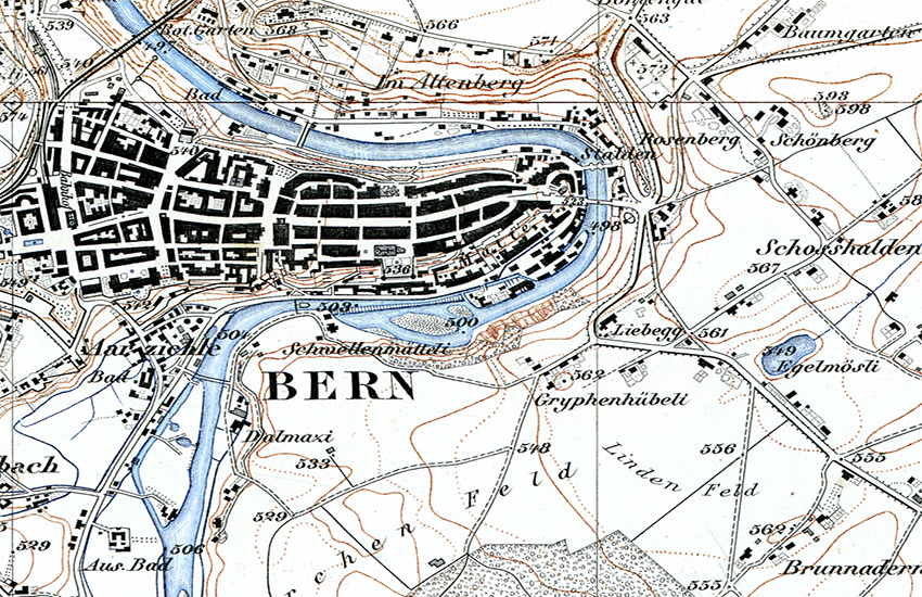
Das Bundesamt für Landestopografie swisstopo hat seit seiner Gründung durch Guillaume-Henri Dufour im Jahre 1838 drei amtliche Landeskartenwerke produziert: die Topographische Karte der Schweiz 1:100’000 (Dufourkarte), den Topographischen Atlas der Schweiz 1:25’000 / 1:50’000 (Siegfriedkarte) und die Landeskarte der Schweiz in verschiedenen Massstäben. Die Gesamtheit dieser Bestände bildet ein Kulturgut von nationaler Bedeutung, das als «topographisches Landschaftsgedächtnis der Schweiz» bezeichnet werden kann. Mit der «Zeitreise» lässt sich der Landschaftswandel anhand dieser Kartenwerke auf interaktive Weise erfahren.
Depuis sa fondation en 1838 par Guillaume-Henri Dufour, l’Office fédéral de topographie swisstopo a produit trois séries de cartes officielles : la Carte topographique de la Suisse 1:100’000 (carte Dufour), l’Atlas topographique de la Suisse 1:25’000 / 1:50’000 (Carte Siegfried) et les Cartes nationales suisses en différentes échelles. L’ensemble de ces fonds constitue un bien culturel d’importance nationale qui peut être qualifié de « mémoire du paysage de la Suisse topographique ». Avec le « voyage dans le temps » l’évolution du paysage peut être perçue de manière interactive sur la base de ces œuvres cartographiques.
A partire dalla sua fondazione nel 1838 ad opera di Guillaume-Henri Dufour, l'Ufficio federale di topografia swisstopo ha prodotto tre serie di carte ufficiali: la Carta topografica della Svizzera 1:100’000 (carta Dufour), l’Atlante topografico della Svizzera 1:25’000 / 1:50’000 (carta Siegfried) e le Carte nazionali della Svizzera in varie scale. L’insieme di questi prodotti costituisce un bene culturale di importanza nazionale, che può essere definito come «memoria paesaggistica della Svizzera». Con il «viaggio nel tempo», l’evoluzione del paesaggio può essere analizzato in maniera interattiva.
Since its foundation in 1838 by Guillaume-Henri Dufour, swisstopo has produced three official national map series, the topographical map of Switzerland 1:100’000 (Dufour Map), the topographical atlas 1:25’000 / 1:50’000 (Siegfried Map) and the Swiss National Maps in different scales. The collection of these products constitutes a cultural asset of national significance which qualifies as a kind of «topographical landscape memory of Switzerland». The «journey through time» allows to interactively explore the evolution of the landscape.
Dapi la fundaziun tras Guillaume-Henri Dufour l'onn 1838 ha l'Uffizi federal da topografia swisstopo producì trais chartas naziunalas uffizialas: la Charta topografica da la Svizra (Charta Dufour), l'Atlas topografic da la Svizra 1:25'000 / 1:50'000 (Charta Siegfried) e la Charta naziunala da la Svizra en differentas scalas. Tut questas chartas furman in bain cultural d'impurtanza naziunala che po vegnir designà sco «memoria topografica da la cuntrada da la Svizra». Cun il «viadi en il temp» sa lascha la transfurmaziun da la cuntrada pertschaiver en moda interactiva a maun da questas chartas.
Simple
-
Autre titreAltri nomi o acronimiAlternate titleAlternate titleAlternativtitel
-
Zeitreise - Kartenwerke
Voyage dans le temps - Cartes
Viaggio nel tempo - Carte
Journey through time - Maps
Viadi en il temp – chartas
-
Date (Publication)Data (Pubblicazione)Date (Publication)Date (Publication)Datum (Publikation)
- 2013-01-14
-
Date (Révision)Data (Revisione)Date (Revision)Date (Revision)Datum (Aktualisierung)
- 2021-03-16
-
IdentifiantIdentificatoreIdentifierIdentifierKennung
- ch.swisstopo.zeitreihen
Point de contact
Punto di contatto
Point of contact
Point of contact
Ansprechpartner
-
Heures de serviceOrario di servizioHours of serviceHours of serviceBetriebszeiten
-
08h30 - 11h00 / 14h00 - 16h00 GMT+1
-
Catégorie de thèmeCategoria ISOTopic categoryTopic categoryThematik
-
-
A Imagerie, cartes de base et occupation du solA Mappe di base con immagini della copertura terrestreA Imagery base maps earth coverA Imagery base maps earth coverA Oberflächenbeschreibung
-
Étendue
Estensione
Extent
Extent
Ausdehnung
Étendue
Estensione
Extent
Extent
Ausdehnung
-
DescriptionDescrizioneDescriptionDescriptionBeschreibung
-
Switzerland
Schweiz
Suisse
Svizzera
Svizra
))

-
Fréquence de mise à jourFrequenza di aggiornamentoMaintenance and update frequencyMaintenance and update frequencyWartungsintervall
-
InconnueSconosciutoUnknownUnknownUnbekannt
- geocat.ch
-
-
carte nationale
carta nazionale
national map
-
carte historique
carta storica
historic map
-
INSPIRE
INSPIRE
INSPIRE
-
- GEMET - INSPIRE themes, version 1.0
-
-
Dénominations géographiques
Nomi geografici
Geographical names
-
- geocat.ch
-
-
BGDI Bundesgeodaten-Infrastruktur
IFDG l’Infrastructure Fédérale de données géographiques
IFDG Infrastruttura federale dei dati geografici
FSDI Federal Spatial Data Infrastructure
-
- geocat.ch
-
-
Topografie
topographie
topografia
topography
-
- GEMET
-
-
Karte
cartogramme
mappa
map chart
-
-
LangueLinguaLanguageLanguageSprache
- Deutsch
-
Encodage de caractèresCodifica dei caratteriCharacter encodingCharacter encodingZeichenkodierung
-
Utf8UTF8UTF8UTF8Utf8
-
Catégorie de sous-thèmeCategoria di sottotemaSubtopic CategorySubtopic CategoryThematische Unterkategorien
-
A1 Cartes de base, modèles de paysageA1 Mappe di base, modelli paesaggisticiA1 Base Maps, Landscape ModelsA1 Base Maps, Landscape ModelsA1 Basiskarten, Landschaftsmodelle
-
Géodonnées de baseGeodati di baseBasic GeodataBasic GeodataGeobasisdaten
- true
-
Identifiant Géodonnées de baseIdentificativo dei geodati di baseBasic Geodata IDBasic Geodata IDIdentifikator des Geobasisdatensatzes
-
49
-
Niveau des géodonnées de baseLivello legale dei geodati di baseBasic Geodata Legal LevelBasic Geodata Legal LevelGeobasisdatenebene
-
FédéralFederaleFederalFederalNational
-
Type de géodonnées de baseTipo di geodati di baseBasic Geodata TypeBasic Geodata TypeGeobasisdatentyp
-
Géodonnées de référenceGeodati di riferimentoReference GeodataReference GeodataGeoreferenzdaten
-
Format de distributionFormato (codifica)Distribution formatDistribution formatAbgabeformat
-
-
Tagged Image File Format (TIFF)
-
Options de transfert numérique
Opzioni di trasferimento digitale
Digital transfer options
Digital transfer options
Optionen für die digitale Übertragung
-
Ressource en ligneRisorsa onlineOnLine resourceOnLine resourceOnline
-
Vorschau map.geo.admin.ch
Vorschau map.geo.admin.chAperçu map.geo.admin.chPrevisione map.geo.admin.chPreview map.geo.admin.ch
Options de transfert numérique
Opzioni di trasferimento digitale
Digital transfer options
Digital transfer options
Optionen für die digitale Übertragung
-
Ressource en ligneRisorsa onlineOnLine resourceOnLine resourceOnline
-
ch.swisstopo.zeitreihen
WMTS-BGDI Dienst, Layer "Zeitreise - Kartenwerke"Service WMTS-IFDG, couche , Layer "Voyage dans le temps - Cartes"Servizio WMTS-IFDG, strato "Viaggio nel tempo - Carte"WMTS-FSDI service, layer "Journey through time - Maps"WMTS-BGDI Dienst, Layer "Zeitreise - Kartenwerke"
Options de transfert numérique
Opzioni di trasferimento digitale
Digital transfer options
Digital transfer options
Optionen für die digitale Übertragung
Options de transfert numérique
Opzioni di trasferimento digitale
Digital transfer options
Digital transfer options
Optionen für die digitale Übertragung
Options de transfert numérique
Opzioni di trasferimento digitale
Digital transfer options
Digital transfer options
Optionen für die digitale Übertragung
Options de transfert numérique
Opzioni di trasferimento digitale
Digital transfer options
Digital transfer options
Optionen für die digitale Übertragung
-
Ressource en ligneRisorsa onlineOnLine resourceOnLine resourceOnline
-
RESTful API von geo.admin.ch
RESTful API von geo.admin.chRESTful API de geo.admin.chRESTful API da geo.admin.chRESTful API from geo.admin.chRESTful API dad geo.admin.ch
-
Nom du système de référenceNome del sistema di riferimentoReference system identifierReference system identifierName des Referenzsystems
- EPSG:21781
Metadata
-
Identifiant des métadonnéesIdentificativo della schedaMetadata identifierMetadata identifierIdentifikator des Metadatensatzes
- 22287cd6-b75b-4caf-9413-aa3f196548b2
-
LangueLinguaLanguageLanguageSprache
- Deutsch
-
Encodage de caractèresCodifica dei caratteriCharacter encodingCharacter encodingZeichenkodierung
-
Utf8UTF8UTF8UTF8Utf8
-
LangueLinguaLanguageLanguageSprache
- Français
-
Encodage de caractèresCodifica dei caratteriCharacter encodingCharacter encodingZeichenkodierung
-
Utf8UTF8UTF8UTF8Utf8
-
LangueLinguaLanguageLanguageSprache
- Italiano
-
Encodage de caractèresCodifica dei caratteriCharacter encodingCharacter encodingZeichenkodierung
-
Utf8UTF8UTF8UTF8Utf8
-
LangueLinguaLanguageLanguageSprache
- English
-
Encodage de caractèresCodifica dei caratteriCharacter encodingCharacter encodingZeichenkodierung
-
Utf8UTF8UTF8UTF8Utf8
-
LangueLinguaLanguageLanguageSprache
- Rumantsch
-
Encodage de caractèresCodifica dei caratteriCharacter encodingCharacter encodingZeichenkodierung
-
Utf8UTF8UTF8UTF8Utf8
Point de contact
Punto di contatto
Point of contact
Point of contact
Ansprechpartner
-
Heures de serviceOrario di servizioHours of serviceHours of serviceBetriebszeiten
-
08h30 - 11h00 / 14h00 - 16h00 GMT+1
Type de ressource
Tipo di risorsa
Type of resource
Type of resource
Anwendungsbereich der Metadaten
-
Domaine d'application de la ressourceAmbito di applicazione della risorsaResource scopeResource scopeDomäne der Ressourcenanwendung
-
Jeu de donnéesSet di datiDatasetDatasetDatenbestand
-
Lien vers la métadonnéeCollegamento ai metadatiMetadata linkageMetadata linkageLink zu den Metadaten
-
https://www.geocat.ch/geonetwork/srv/api/records/22287cd6-b75b-4caf-9413-aa3f196548b2
-
Informations de date (Création)Informazioni sulla data (Creazione)Date info (Creation)Date info (Creation)Datumsangaben (Erstellung)
- 2012-12-04T12:59:30Z
-
Informations de date (Révision)Informazioni sulla data (Revisione)Date info (Revision)Date info (Revision)Datumsangaben (Aktualisierung)
- 2026-04-13T09:17:56.364366Z
Norme des métadonnées
Standard dei metadati
Metadata standard
Metadata standard
Metadatenstandard
-
TitreTitoloTitleTitleTitel
-
GM03_2