geocat.ch
Carte Dufour (VS)
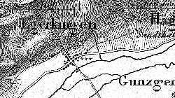
Entre 1845 et 1865, la première série de cartes officielles de la Suisse a été publiée à l'échelle 1:100'000 sous la direction du général Henri-Guillaume Dufour. Dufour a été également le fondateur et le premier directeur du Bureau topographique fédéral qu'il établit à Genève en 1838. Les 25 feuilles de la « carte Dufour » ne comportaient qu'une couleur et utilisaient le mode de reproduction de la gravure sur cuivre. Une fois la première édition terminée en 1865, cette série de cartes a été distinguée à plusieurs reprises sur la scène internationale et mise à jour jusqu'à son remplacement par la nouvelle carte nationale au 1:100'000. Depuis 2006, toutes les éditions sont disponibles sous forme numérique pour des analyses du développement du paysage et d'autres applications.
Simple
- Alternate title
-
Carte Dufour Première édition (VS)
- Date (Creation)
- 1865-12-31
- Identifier
- 204
- Purpose
-
données de référence
- Status
- Historical archive
Custodian
- Spatial representation type
- Grid
Spatial resolution
Equivalent scale
- Denominator
- 100000
- Topic category
-
- A Imagery base maps earth cover
Extent
Extent
- Description
-
Canton of Valais (VS)
))

- Maintenance and update frequency
- Not planned
Resource format
- Title
-
ESRI Enterprise Geodatabase
- Date
- GEMET
-
-
cartography
-
- geocat.ch
-
-
official geodata
-
terrain representation
-
historic map
-
national map
-
topography
-
- GEMET
-
-
map chart
-
Resource constraints
- Use limitation
-
sous licence
Resource constraints
- Access constraints
- Other restrictions
- Other constraints
-
Géodonnées accessibles au public (niveau A selon l'OGéo)
- Other constraints
-
Les conditions générales d'utilisation des géodonnées du Canton du Valais font foi ( https://www.vs.ch/fr/web/guest/information-legale).
- Language
- Français
- Character encoding
- UTF8
- Language
- Deutsch
- Character encoding
- UTF8
- Environment description
-
S:\Géodonnées VS\A1 Cartes de référence\Dufour 1842-1920.lyr S:\Géodonnées VS\A1 Cartes de référence\Dufour 1842-1920 Index.lyr
- Subtopic Category
- A1 Base Maps, Landscape Models
- Basic Geodata
- true
- Basic Geodata ID
-
49.2
- Basic Geodata Legal Level
- Federal
- Basic Geodata Type
- Reference Geodata
- Distribution format
-
-
GeoTIFF (GEOTIFF)
-
Cloud Optimized GeoTIFF (TIFF / TIF)
-
Distributor
- Statement
-
basés sur des relevés fédéraux et cantonaux
- Hierarchy level
- Dataset
- Reference system identifier
- EPSG:2056/CH1903+_MN95
Metadata
- Metadata identifier
- 1f0bd44e-6d9a-493e-9fbc-0453dcf5cf95
- Language
- Français
- Character encoding
- UTF8
- Language
- Deutsch
- Character encoding
- UTF8
- Language
- Italiano
- Character encoding
- UTF8
- Language
- English
- Character encoding
- UTF8
- Language
- Rumantsch
- Character encoding
- UTF8
Distributor
Type of resource
- Resource scope
- Dataset
- Metadata linkage
-
https://www.geocat.ch/geonetwork/srv/api/records/1f0bd44e-6d9a-493e-9fbc-0453dcf5cf95
- Date info (Creation)
- 2014-12-16T17:11:28Z
- Date info (Revision)
- 2026-05-18T11:53:49.779264Z
Metadata standard
- Title
-
eCH-0271