 geocat.ch
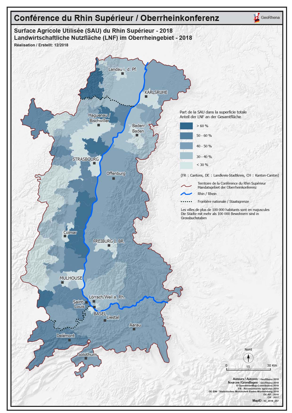
Surface Agricole Utilisée PDF - 2018 / Landwirtschaftliche Nutzfläche PDF - 2018
Carte PDF de la Surface Agricole Utilisée (SAU) du Rhin Supérieur - 2018
PDF Karte der Landwirtschaftliche Nutzfläche (LNF) im Oberrheingebiet - 2018
Simple
-
Date (Création)
- 2019-01-24
-
Forme de la présentation
-
Carte papier
-
État
-
Terminé
-
Catégorie de thème
-
-
S Élevage
-
Étendue
Étendue
N
S
E
W
))
-
Fréquence de mise à jour
-
Inconnue
- Keywords
-
-
SAU;LNF;Surface Agricole Utilisée;Landwirtschaftliche Nutzfläche;2018;PDF;carte;Karte
-
Contraintes sur la ressource
-
Limitation d'utilisation
-
© OSM contributors - GeoRhena - Chambre régionale d’agriculture Grand Est
-
Contraintes d'utilisation
-
Droit d’auteur
-
Langue
- Français
-
Informations supplémentaires
-
© Copyright GeoRhena / Michelin/ OSM 2018
-
Format de distribution
-
-
PDF
-
Metadata
-
Identifiant des métadonnées
- 1d7835c6-b4d5-456b-87a8-57ca1eb4110d
-
Langue
- Français
-
Encodage de caractères
-
Utf8
Type de ressource
-
Domaine d'application de la ressource
-
staticMap
-
Nom
-
© Michelin 2018
-
Informations de date (Révision)
- 2025-06-18T14:42:07.408976Z
Norme des métadonnées
-
Titre
-
ISO 19115-3:2018
-
Édition
-
1.0
)))