geocat.ch
Regional geothermal potential studies in Switzerland and Principality of Liechtenstein
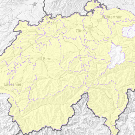
This map shows the existing geothermal potential studies in Switzerland (per Canton) and Liechtenstein. The data basis that allowed the realization of this map comes from the report «Geothermie für die Nah- und Fernwärmeversorgung – Überblick über die kantonalen und nationalen Geothermie-Potenzialstudien, Nutzungsmöglichkeiten und Anwendungsbeispiele» from K. Link and O. Zingg and appointed by SwissEnergy. This report is available under the following link: <a href=" https://geothermie-schweiz.ch/geothermie-fuer-die-nah-und-fernwaermeversorgung" target="_blank">https://geothermie-schweiz.ch</a>. Data was controlled and updated in order to ensure the highest possible accuracy of the displayed information .
Simple
- Alternate title
-
Geothermal potential studies
- Date (Creation)
- 2018-08-10T00:00:00
- Date (Revision)
- 2026-03-16T00:00:00
- Identifier
- ch.swisstopo.geologie-geothermische_potenzialstudien_regional
- Status
- On going
Owner
- Spatial representation type
- Vector
- Topic category
-
- F Geoscientific information
Extent
Extent
- Description
-
Switzerland (extent of the railway network with areas close to the border)
- Geographic identifier
- CH
))

- Maintenance and update frequency
- As needed
- geocat.ch
-
-
confederation
-
geothermal energy
-
opendata.swiss
-
FSDI Federal Spatial Data Infrastructure
-
EGDI (European Geological Data Infrastructure)
-
- GEMET
-
-
energy resource
-
geothermal energy
-
geophysical environment
-
Resource constraints
- Other constraints
- Opendata BY: Open use. Must provide the source.
- Language
- Deutsch
- Character encoding
- UTF8
- Language
- Français
- Character encoding
- UTF8
- Language
- Italiano
- Character encoding
- UTF8
- Language
- English
- Character encoding
- UTF8
- Subtopic Category
- F1 Geology
- Subtopic Category
- Q1 Energy
- Distribution format
-
-
ESRI File Geodatabase FileGDB (GDB)
-
Digital transfer options
- OnLine resource
-
Vorschau map.geo.admin.ch
Preview map.geo.admin.ch
Digital transfer options
- OnLine resource
-
ch.swisstopo.geologie-geothermische_potenzialstudien_regional
WMS-FSDI service, layer "Geothermal potential studies"
Digital transfer options
- OnLine resource
-
Download
Digital transfer options
- OnLine resource
-
viewer.swissgeol.ch
Digital transfer options
- OnLine resource
-
RESTful API von geo.admin.ch
RESTful API from geo.admin.ch
Identifier
- Code
- EPSG:2056
- Description
-
CH1903+ / LV95 (EPSG:2056)
Metadata
- Metadata identifier
- 1c050393-fe3a-41b1-a31e-3173f51181d8
- Language
- Deutsch
- Character encoding
- UTF8
- Language
- Français
- Character encoding
- UTF8
- Language
- Italiano
- Character encoding
- UTF8
- Language
- English
- Character encoding
- UTF8
- Language
- Rumantsch
- Character encoding
- UTF8
Owner
Type of resource
- Resource scope
- Dataset
- Metadata linkage
-
https://www.geocat.ch/geonetwork/srv/api/records/1c050393-fe3a-41b1-a31e-3173f51181d8
- Date info (Creation)
- 2017-07-12T08:12:12Z
- Date info (Revision)
- 2026-09-15T12:10:33.618882Z
Metadata standard
- Title
-
eCH-0271