geocat.ch
Neophytenstandorte
Neophyte sites
Der Geodatensatz umfasst die bekannten Standorten von Neophyten in Liechtenstein. Gemäss Freisetzungsverordnung LGBl. 2011 Nr. 90 (FrSV) sind Mensch, Tier und Umwelt vor pathogenen oder gebietsfremden Organismen zu schützen.
Invasive gebietsfremde Pflanzen sind nicht-einheimische Pflanzen, die aus fremden Gebieten (meist aus anderen Kontinenten), absichtlich oder unabsichtlich, eingeführt wurden, die sich bei uns in der Natur etablieren (Vermehrung in freier Natur) und sich auf Kosten einheimischer Arten effizient ausbreiten.
The geodata set includes the known locations of neophytes in Liechtenstein. According to the Release Ordinance LGBl. 2011 No. 90 (FrSV), humans, animals and the environment must be protected from pathogenic or alien organisms.
Invasive alien plants are non-native plants that have been introduced from foreign regions (usually from other continents), intentionally or unintentionally, that become established in nature (reproduction in the wild) and spread efficiently at the expense of native species.
Simple
-
Autre titreAltri nomi o acronimiAlternate titleAlternativtitel
-
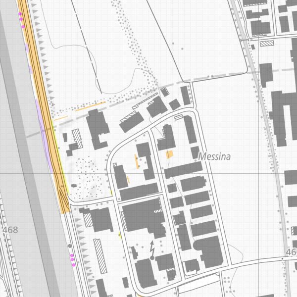
Karte der Neophytenstandorte (Liechtenstein)
Map of neophyte locations (Liechtenstein)
-
Date (Création)Data (Creazione)Date (Creation)Datum (Erstellung)
- 2013-11-13
-
IdentifiantIdentificatoreIdentifierKennung
- https://metadata.geo.llv.li/1a7515a1-3353-45a2-9d41-d9b0061af89b
-
ButScopoPurposeZweck
-
Bekämpfung der Neophyten
Combating neophytes
-
ÉtatStatoStatusBearbeitungsstatus
-
TerminéCompletatoCompletedAbgeschlossen
responsable de la publication
Editore
Publisher
Herausgeber
-
Heures de serviceOrario di servizioHours of serviceBetriebszeiten
-
8:00-11:30 und 13:30-17:00
Propriétaire
Proprietario
Owner
Eigentümer
-
Heures de serviceOrario di servizioHours of serviceBetriebszeiten
-
8:00-11:30 und 13:30-17:00
-
Type de représentation spatialeTipo di rappresentazione spazialeSpatial representation typeRäumliche Darstellungsart
-
vecteurVettorialeVectorVektor
Résolution spatiale
Risoluzione spaziale
Spatial resolution
Räumliche Auflösung
Fraction représentative
Frazione rappresentativa
Equivalent scale
Vergleichsmassstab
-
DénominateurDenominatoreDenominatorMassstabszahl
- 500
-
Catégorie de thèmeCategoria ISOTopic categoryThematik
-
-
F Informations géoscientifiquesF Informazioni geoscientificheF Geoscientific informationF Erdwissenschaften
-
Étendue
Estensione
Extent
Ausdehnung
Étendue
Estensione
Extent
Ausdehnung
-
DescriptionDescrizioneDescriptionBeschreibung
-
Liechtenstein
Liechtenstein
Liechtenstein
Liechtenstein
))

-
Fréquence de mise à jourFrequenza di aggiornamentoMaintenance and update frequencyWartungsintervall
-
Comme nécessaireSecondo necessitàAs neededBei Bedarf
- GEMET
-
-
protection de la faune et de la flore
protezione della flora e della fauna
wildlife protection
-
population végétale
popolazione vegetale
plant population
-
espèce végétale
specie vegetale
plant species
-
- geocat.ch
-
-
INSPIRE
INSPIRE
INSPIRE
-
OpenData
OpenData
OpenData
-
néobiote
neobiota
neobiota
-
- GEMET - INSPIRE themes, version 1.0
-
-
Répartition des espèces
Distribuzione delle specie
Species distribution
-
Contraintes sur la ressource
Vincoli sulle risorse
Resource constraints
Ressourcenbeschränkungen
-
Limitation d'utilisationLimitazione d'usoUse limitationNutzungsbeschränkung
-
keine
No Conditions apply
-
Contraintes d'accèsVincoli di accessoAccess constraintsZugriffsbeschränkungen
-
Autres restrictionsAltre restrizioniOther restrictionsAndere Beschränkungen
-
Contraintes d'utilisationVincoli d'usoUse constraintsNutzungseinschränkungen
-
Autres restrictionsAltre restrizioniOther restrictionsAndere Beschränkungen
-
Autres contraintesAltri vincoliOther constraintsAndere Einschränkungen
- No limitations to public accessNo limitations to public accessNo limitations to public accessNo limitations to public access
Contraintes sur la ressource
Vincoli sulle risorse
Resource constraints
Ressourcenbeschränkungen
-
Contraintes d'accèsVincoli di accessoAccess constraintsZugriffsbeschränkungen
-
Autres restrictionsAltre restrizioniOther restrictionsAndere Beschränkungen
-
Contraintes d'utilisationVincoli d'usoUse constraintsNutzungseinschränkungen
-
Autres restrictionsAltre restrizioniOther restrictionsAndere Beschränkungen
-
Autres contraintesAltri vincoliOther constraintsAndere Einschränkungen
- No conditions to access and useNo conditions to access and useNo conditions to access and useNo conditions to access and use
-
Autres contraintesAltri vincoliOther constraintsAndere Einschränkungen
- Opendata BY: Freie Nutzung. Quellenangabe ist Pflicht.Opendata BY: Utilisation libre. Obligation d’indiquer la source.Opendata BY: Libero utilizzo. Indicazione della fonte obbligatoria.Opendata BY: Open use. Must provide the source.
-
LangueLinguaLanguageSprache
- Deutsch
-
Encodage de caractèresCodifica dei caratteriCharacter encodingZeichenkodierung
-
Utf8UTF8UTF8Utf8
-
Catégorie de sous-thèmeCategoria di sottotemaSubtopic CategoryThematische Unterkategorien
-
F2 SolsF2 SuoliF2 SoilsF2 Boden
-
Format de distributionFormato (codifica)Distribution formatAbgabeformat
-
-
INTERLIS 1 (ITF)
-
AutoCAD DXF (DXF)
-
ESRI Shapefile (SHP)
-
Point de contact
Punto di contatto
Point of contact
Ansprechpartner
-
Heures de serviceOrario di servizioHours of serviceBetriebszeiten
-
8:00-11:30 und 13:30-17:00
Options de transfert numérique
Opzioni di trasferimento digitale
Digital transfer options
Optionen für die digitale Übertragung
-
Ressource en ligneRisorsa onlineOnLine resourceOnline
-
Geodatenportal der Liechtensteinische Landesverwaltung
GeodatenportalGeodata portal
Options de transfert numérique
Opzioni di trasferimento digitale
Digital transfer options
Optionen für die digitale Übertragung
-
Ressource en ligneRisorsa onlineOnLine resourceOnline
-
OGC WMS Service der Liechtensteinen Landesverwaltung
OGC WMS Service der Liechtensteinen LandesverwaltungOGC WMS Service of the Liechtenstein State Administration
Options de transfert numérique
Opzioni di trasferimento digitale
Digital transfer options
Optionen für die digitale Übertragung
-
Ressource en ligneRisorsa onlineOnLine resourceOnline
-
Zip Download über das Geodatenportal
Zip Download über das GeodatenportalZip download via the geodata portal
-
NiveauLivelloHierarchy levelBezugsebene
-
Jeu de donnéesSet di datiDatasetDatenbestand
-
AutreAltroOtherSonstiges
-
Alle Ebenen
Rapport sur la qualité
Rapporto sulla qualità
Report
Qualitätsbericht
Result
Risultato
Result
Ergebnis
-
TitreTitoloTitleTitel
-
VERORDNUNG (EG) Nr. 1089/2010 DER KOMMISSION vom 23. November 2010 zur Durchführung der Richtlinie 2007/2/EG des Europäischen Parlaments und des Rates hinsichtlich der Interoperabilität von Geodatensätzen und -diensten
Règlement (UE) n o 1089/2010 de la commission du 23 novembre 2010 portant modalités d'application de la directive 2007/2/ce du Parlement Européen et du conseil en ce qui concerne l'interopérabilité des séries et des services de données géographiques
REGOLAMENTO (UE) N. 1089/2010 DELLA COMMISSIONE del 23 novembre 2010 recante attuazione della direttiva 2007/2/CE del Parlamento europeo e del Consiglio per quanto riguarda l'interoperabilità dei set di dati territoriali e dei servizi di dati territoriali
COMMISSION REGULATION (EU) No 1089/2010 of 23 November 2010 implementing Directive 2007/2/EC of the European Parliament and of the Council as regards interoperability of spatial data sets and services
-
Date (Publication)Data (Pubblicazione)Date (Publication)Datum (Publikation)
- 2010-12-08
-
ExplicationSpiegazioneExplanationErläuterung
-
nicht geprüft
-
Degré de conformitéGrado di conformitàPassKonformitätsgrad
- false
-
Généralités sur la provenanceInformazioni generali sulla provenienzaStatementErklärung
-
Crowdsourcing
-
NiveauLivelloHierarchy levelBezugsebene
-
Jeu de donnéesSet di datiDatasetDatenbestand
-
AutreAltroOtherSonstiges
-
Alle Ebenen
-
Niveau de topologieLivello di topologiaTopology levelTopologieebene
-
Topologie de réseau complèteGrafo planare completoFull planar graphVollständige Netzwerktopologie
-
Type d’objet géométriqueTipo di oggetto geometricoGeometric object typeTyp des geometrischen Objekts
-
PolygoneSuperficieSurfacesurface
-
Nombre d’objets géométriquesNumero di oggetti geometriciGeometric object countAnzahl geometrischer Objekte
- 1
-
Nom du système de référenceNome del sistema di riferimentoReference system identifierName des Referenzsystems
- http://www.opengis.net/def/crs/EPSG/0/21782
-
Nom du système de référenceNome del sistema di riferimentoReference system identifierName des Referenzsystems
- http://www.opengis.net/def/crs/EPSG/0/4936
-
Fréquence de mise à jourFrequenza di aggiornamentoMaintenance and update frequencyWartungsintervall
-
Comme nécessaireSecondo necessitàAs neededBei Bedarf
Metadata
-
Identifiant des métadonnéesIdentificativo della schedaMetadata identifierIdentifikator des Metadatensatzes
- 1a7515a1-3353-45a2-9d41-d9b0061af89b
-
LangueLinguaLanguageSprache
- Deutsch
-
Encodage de caractèresCodifica dei caratteriCharacter encodingZeichenkodierung
-
Utf8UTF8UTF8Utf8
-
LangueLinguaLanguageSprache
- Français
-
Encodage de caractèresCodifica dei caratteriCharacter encodingZeichenkodierung
-
Utf8UTF8UTF8Utf8
-
LangueLinguaLanguageSprache
- Italiano
-
Encodage de caractèresCodifica dei caratteriCharacter encodingZeichenkodierung
-
Utf8UTF8UTF8Utf8
-
LangueLinguaLanguageSprache
- English
-
Encodage de caractèresCodifica dei caratteriCharacter encodingZeichenkodierung
-
Utf8UTF8UTF8Utf8
Point de contact
Punto di contatto
Point of contact
Ansprechpartner
-
Heures de serviceOrario di servizioHours of serviceBetriebszeiten
-
8:00-11:30 und 13:30-17:00
Type de ressource
Tipo di risorsa
Type of resource
Anwendungsbereich der Metadaten
-
Domaine d'application de la ressourceAmbito di applicazione della risorsaResource scopeDomäne der Ressourcenanwendung
-
Jeu de donnéesSet di datiDatasetDatenbestand
-
Informations de date (Création)Informazioni sulla data (Creazione)Date info (Creation)Datumsangaben (Erstellung)
- 2021-04-21T12:47:49Z
-
Informations de date (Révision)Informazioni sulla data (Revisione)Date info (Revision)Datumsangaben (Aktualisierung)
- 2026-04-13T09:31:45.887644Z
Norme des métadonnées
Standard dei metadati
Metadata standard
Metadatenstandard
-
TitreTitoloTitleTitel
-
eCH-0271