geocat.ch
Offizieller Stadtplan
Offizielle Stadtpläne im Rasterformat (farbig, Graustufen und Schwarz-Weiss)
Simple
-
Date (Création)Data (Creazione)Date (Creation)Datum (Erstellung)
- 1998-01-01
-
ÉtatStatoStatusBearbeitungsstatus
-
TerminéCompletatoCompletedAbgeschlossen
Propriétaire
Proprietario
Owner
Eigentümer
-
Type de représentation spatialeTipo di rappresentazione spazialeSpatial representation typeRäumliche Darstellungsart
-
grilleRasterGridRaster, Gitter
-
Catégorie de thèmeCategoria ISOTopic categoryThematik
-
-
A Imagerie, cartes de base et occupation du solA Mappe di base con immagini della copertura terrestreA Imagery base maps earth coverA Oberflächenbeschreibung
-
Étendue
Estensione
Extent
Ausdehnung
Étendue
Estensione
Extent
Ausdehnung
-
DescriptionDescrizioneDescriptionBeschreibung
-
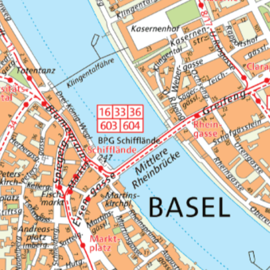
Basel-Stadt und Umgebung
Basel-Stadt (Stadtplanperimeter)
Basel-Stadt und Umgebung
Basel-Stadt und Umgebung
-
Identifiant géographiqueIdentificatore geograficoGeographic identifierGeografische Kennung
- Basel-Stadt (und Umgebung)Basel-Stadt (Stadtplanperimeter)Basel-Stadt (und Umgebung)Basel-Stadt (und Umgebung)
))

-
Fréquence de mise à jourFrequenza di aggiornamentoMaintenance and update frequencyWartungsintervall
-
AnnuelleAnnualmenteAnnuallyJährlich
- geocat.ch
-
-
plan de ville
carta di città
city map
-
- geocat.ch
-
-
opendata.swiss
opendata.swiss
opendata.swiss
-
Contraintes sur la ressource
Vincoli sulle risorse
Resource constraints
Ressourcenbeschränkungen
-
Autres contraintesAltri vincoliOther constraintsAndere Einschränkungen
-
Die Geodaten sind öffentlich zugänglich. (Zugangsberechtigungsstufe [A] = öffentlich)
-
Autres contraintesAltri vincoliOther constraintsAndere Einschränkungen
-
Es gelten die Nutzungsbedingungen für Geodaten des Kantons Basel-Stadt. ( http://www.geo.bs.ch/agb)
Ressource associée
Risorsa associata
Associated resource
Verlinkte Ressource
-
TitreTitoloTitleTitel
-
Offizieller Stadtplan
-
Type d'associationTipo di associazioneAssociation TypeAssoziationstyp
-
Citation de travail plus largeCitazione di un'opera più ampiaReference to a master resource of which this one is a partÜbergeordneter Datenbestand
-
LangueLinguaLanguageSprache
- Deutsch
-
Encodage de caractèresCodifica dei caratteriCharacter encodingZeichenkodierung
-
Utf8UTF8UTF8Utf8
-
Catégorie de sous-thèmeCategoria di sottotemaSubtopic CategoryThematische Unterkategorien
-
A1 Cartes de base, modèles de paysageA1 Mappe di base, modelli paesaggisticiA1 Base Maps, Landscape ModelsA1 Basiskarten, Landschaftsmodelle
-
Géodonnées de baseGeodati di baseBasic GeodataGeobasisdaten
- true
-
Identifiant Géodonnées de baseIdentificativo dei geodati di baseBasic Geodata IDIdentifikator des Geobasisdatensatzes
-
11-BS
-
Niveau des géodonnées de baseLivello legale dei geodati di baseBasic Geodata Legal LevelGeobasisdatenebene
-
CantonalCantonalCantonalKantonal
-
Type de géodonnées de baseTipo di geodati di baseBasic Geodata TypeGeobasisdatentyp
-
openDataopenDataopenDataopenData
-
Format de distributionFormato (codifica)Distribution formatAbgabeformat
-
-
Tagged Image File Format (TIFF)
-
JPEG (JPG)
-
Distributeur
Distributore
Distributor
Verteiler
-
Heures de serviceOrario di servizioHours of serviceBetriebszeiten
-
Mo - Do: 8:00 bis 12:00, 13:30 bis 16:30, Fr: 8:00 bis 12:00, 13:30 bis 16:00
Options de transfert numérique
Opzioni di trasferimento digitale
Digital transfer options
Optionen für die digitale Übertragung
-
Ressource en ligneRisorsa onlineOnLine resourceOnline
-
MapBS
Öffentliches Auskunftssystem des Kantons Basel-Stadt
Options de transfert numérique
Opzioni di trasferimento digitale
Digital transfer options
Optionen für die digitale Übertragung
-
Ressource en ligneRisorsa onlineOnLine resourceOnline
-
Geodaten-Shop
Öffentlich zugänglicher Geodaten-Downloaddienst des Kantons Basel-Stadt
Options de transfert numérique
Opzioni di trasferimento digitale
Digital transfer options
Optionen für die digitale Übertragung
-
Ressource en ligneRisorsa onlineOnLine resourceOnline
-
WMS BS
Die derzeit im WMS BS verfügbaren Datenebenen entsprechen, bis auf wenige Ausnahmen, den Geodaten, welche auch in MapBS dargestellt sind. Der WMS BS ist kostenlos nutzbar und bietet Zugriff auf öffentliche sowie beschränkt öffentliche Geodaten, wobei gegebenenfalls Benutzername und Passwort benötigt werden (Zugangsdaten von MapBS).
Options de transfert numérique
Opzioni di trasferimento digitale
Digital transfer options
Optionen für die digitale Übertragung
-
Ressource en ligneRisorsa onlineOnLine resourceOnline
-
Permalink opendata.swiss
Permalink opendata.swissPermalink opendata.swissPermalink opendata.swissPermalink opendata.swiss
-
Nom du système de référenceNome del sistema di riferimentoReference system identifierName des Referenzsystems
- CH1903+ / LV95/EPSG: 2056
Metadata
-
Identifiant des métadonnéesIdentificativo della schedaMetadata identifierIdentifikator des Metadatensatzes
- 175ace16-97e3-4ca6-82bd-a80a98ac7ad7
-
LangueLinguaLanguageSprache
- Deutsch
-
Encodage de caractèresCodifica dei caratteriCharacter encodingZeichenkodierung
-
Utf8UTF8UTF8Utf8
-
LangueLinguaLanguageSprache
- Français
-
Encodage de caractèresCodifica dei caratteriCharacter encodingZeichenkodierung
-
Utf8UTF8UTF8Utf8
-
LangueLinguaLanguageSprache
- Italiano
-
Encodage de caractèresCodifica dei caratteriCharacter encodingZeichenkodierung
-
Utf8UTF8UTF8Utf8
-
LangueLinguaLanguageSprache
- English
-
Encodage de caractèresCodifica dei caratteriCharacter encodingZeichenkodierung
-
Utf8UTF8UTF8Utf8
Dépositaire
Custode
Custodian
Verwalter
Type de ressource
Tipo di risorsa
Type of resource
Anwendungsbereich der Metadaten
-
Domaine d'application de la ressourceAmbito di applicazione della risorsaResource scopeDomäne der Ressourcenanwendung
-
Jeu de donnéesSet di datiDatasetDatenbestand
-
Lien vers la métadonnéeCollegamento ai metadatiMetadata linkageLink zu den Metadaten
-
https://www.geocat.ch/geonetwork/srv/api/records/175ace16-97e3-4ca6-82bd-a80a98ac7ad7
-
Informations de date (Création)Informazioni sulla data (Creazione)Date info (Creation)Datumsangaben (Erstellung)
- 2014-09-23T11:56:00Z
-
Informations de date (Révision)Informazioni sulla data (Revisione)Date info (Revision)Datumsangaben (Aktualisierung)
- 2026-04-13T09:24:04.512311Z
Norme des métadonnées
Standard dei metadati
Metadata standard
Metadatenstandard
-
TitreTitoloTitleTitel
-
GM03 Basel-Stadt
-
ÉditionEdizioneEditionAusgabe
-
2.0