geocat.ch
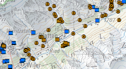
Résurgences, captages et installations d'alimentation artificielle
Les données relatives aux sources et captages comprennent les sources et puits captés ou non captés, les galeries de captage et les prises d’eau qui sont d’intérêt public ou privé par l’alimentation en eau potable, mais également les installations d'alimentation artificielle d’aquifères. Ces données concernent la Carte de protection des eaux, la Carte des eaux souterraines et l’Atlas de l'approvisionnement en eau.
Simple
- Alternate title
-
Cadastre des sources
- Date (Creation)
- 2012-11-11
- Date (Revision)
- 2025-08-29
- Edition
-
Version 0.7 (22.03.2016)
- Identifier
- 94
- Purpose
-
Jeux de géodonnées de droit fédéral N° 141.1 et 139.2
- Status
- On going
Custodian
- Spatial representation type
- Vector
Spatial resolution
Equivalent scale
- Denominator
- 10000
- Topic category
-
- Q Utilities communication
Extent
Extent
- Description
-
Canton of Valais (VS)
))

- Maintenance and update frequency
- Continual
- Maintenance note
-
Les géodonnées relatives aux sources et captages sont mises à jour et intégrées à la base de données hydrogéologiques cantonale gérée par la section Protection des eaux du SPE, suite au captage de nouvelles sources, au raccordement de captages existants au réseau d’eau potable ou à l’abandon de captages pour l’alimentation en eau potable.
Resource format
- Title
-
ESRI Enterprise Geodatabase
- Date
- GEMET
-
-
mineral water
-
spring (hydrology, land)
-
water resources management
-
thermal water
-
geology
-
drinking water
-
resources
-
water collection
-
hydrogeology
-
- geocat.ch
-
-
pipeline cadastre
-
lithology
-
opendata.swiss
-
official geodata
-
- GEMET
-
-
groundwater protection
-
- geocat.ch
-
-
protection zone
-
Resource constraints
- Use limitation
-
Aucune contrainte
Resource constraints
- Access constraints
- Other restrictions
- Other constraints
-
Géodonnées accessibles au public (niveau A selon l'OGéo)
- Other constraints
-
Les conditions générales d'utilisation des géodonnées du Canton du Valais font foi ( https://www.vs.ch/fr/web/guest/information-legale).
- Language
- Français
- Character encoding
- UTF8
- Language
- Deutsch
- Character encoding
- UTF8
- Environment description
-
S:\Géodonnées VS\Q2 Systèmes eaux et déchets\Sources.lyr
- Subtopic Category
- Q2 Water and Waste Systems
- Basic Geodata
- true
- Basic Geodata ID
-
141>A.1 et 139>A.2
- Basic Geodata Legal Level
- Cantonal
- Basic Geodata Type
- basicGeodata
- Included with dataset
- 0
- Title
-
Aide à l'Exécution 4 - Annexe A: Modèle sémantique (Catalogue des objets)
- Date (Creation)
- 2016-08-02
- Distribution format
-
-
ESRI Shapefile (SHP)
-
OGC Web Map Service (WMS)
-
ArcGIS REST Feature Service
-
Distributor
Digital transfer options
- OnLine resource
-
Géoportail du Canton du Valais
Géoportail du Canton du Valais
Digital transfer options
- OnLine resource
-
Landing Page
Landing Page pour opendata
Digital transfer options
- OnLine resource
-
Landing Page
Landing Page pour opendata
Digital transfer options
- OnLine resource
-
Permalink opendata.swiss
Permalink opendata.swiss
Digital transfer options
- OnLine resource
-
OpenData Valais
OpenData Valais - Site de téléchargement de géodonnées à l'Etat du Valais : multiformat et WebMercator
Digital transfer options
- OnLine resource
-
37
ESOUTERR_Sources_Privee
Digital transfer options
- OnLine resource
-
38
ESOUTERR_Sources_Public
Digital transfer options
- OnLine resource
-
Sources_Public
Cartes des eaux souterraines
Digital transfer options
- OnLine resource
-
Sources_Privee
Cartes des eaux souterraines
- Statement
-
Données ponctuelles provenant d'études hydrogéologiques ou de relevés communaux
- Hierarchy level
- Dataset
- Description
-
Base de données relationelle. Précision planimétrique 10 à 25 m. Echelle rerpésentative de 10'000 à 25'000
Equivalent scale
- Denominator
- 25000
- Geometric object type
- Point
- Geometric object count
- 4562
- Reference system identifier
- EPSG:2056/CH1903+_MN95
- Title
-
Aide à l'Exécution 4 - Annexe C1: Sources, captages et installations d'alimentation artificielle des eaux souterraines
- Date (Publication)
- 2013-09-01
Metadata
- Metadata identifier
- 13c8d6a0-0e83-4971-a976-4be0865d873c
- Language
- Français
- Character encoding
- UTF8
- Language
- Deutsch
- Character encoding
- UTF8
- Language
- Italiano
- Character encoding
- UTF8
- Language
- English
- Character encoding
- UTF8
- Language
- Rumantsch
- Character encoding
- UTF8
Distributor
Type of resource
- Resource scope
- Dataset
- Metadata linkage
-
https://www.geocat.ch/geonetwork/srv/api/records/13c8d6a0-0e83-4971-a976-4be0865d873c
- Date info (Creation)
- 2016-12-06T15:47:12Z
- Date info (Revision)
- 2026-04-13T09:17:22.757611Z
Metadata standard
- Title
-
eCH-0271