 geocat.ch
Vernetzungsprojekte nach ÖQV
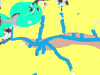
Ökoflächen tragen vor allem dann zur Erhaltung und Förderung der Artenvielfalt bei, wenn sie bestimmte Zeigerarten und Strukturelemente aufweisen und/oder wenn diese an einem ökologisch sinnvollen Standort liegen. Diese Standorte werden im Kanton Bern mittels Vernetzungsprojekten definiert.
Das Geoprodukt VERNETZ besteht aus drei Ebenen, dem Projektperimeter, den Landschaftseinheiten und den Massnahmengebieten.
Simple
- Date (Creation)
- 2012-02-13
- Date (Revision)
- 2026-01-01
- Date (Publication)
- 2026-01-08
- Identifier
- VERNETZ
- Status
- On going
Owner
Principal investigator
Principal investigator
- Topic category
-
- S Farming
Extent
Extent
- Description
- Kanton Bern Canton de Berne
))
- Maintenance and update frequency
- Irregular
- Keywords
-
-
Raumplanung
-
Landwirtschaft
-
Artenvielfalt
-
opendata.swiss
-
Resource constraints
- Use limitation
-
Auf sämtlichen Plots und Publikationen ist der Vermerk "Vernetzungsprojekte nach ÖQV © Amt für Landwirtschaft und Natur des Kantons Bern" anzugeben.
Resource constraints
- Use constraints
- Licence End User
- Other constraints
- Die Daten dürfen gemäss Nutzungsbedingungen frei genutzt werden. Les données peuvent être utilisées librement selon les conditions d’utilisation.
Resource constraints
- Other constraints
- Freie Nutzung. Quellenangabe ist Pflicht. Utilisation libre. Obligation d’indiquer la source.
- Language
- Deutsch
- Character encoding
- UTF8
- Language
- Français
- Character encoding
- UTF8
- Language
- Italiano
- Character encoding
- UTF8
- Language
- English
- Character encoding
- UTF8
- Basic Geodata
- true
- Basic Geodata ID
-
83-BE
- Basic Geodata Legal Level
- Cantonal
- Included with dataset
- false
- Distribution format
-
-
SHP
-
GPKG
-
GeoParquet
-
Digital transfer options
- Transfer size
- 41985570
- OnLine resource
-
ZIP-Datei mit Shapefile, Metadaten und Begleitdaten
Digital transfer options
- Transfer size
- 42828396
- OnLine resource
-
ZIP-Datei mit Geopackage mit Metadaten
Digital transfer options
- Transfer size
- 771560
- OnLine resource
-
Geoparquet-Datei - Landschaftseinheiten Vernetzung
Digital transfer options
- Transfer size
- 32765729
- OnLine resource
-
Geoparquet-Datei - Massnahmengebiete Vernetzung
Digital transfer options
- Transfer size
- 425408
- OnLine resource
-
Geoparquet-Datei - Projektperimeter Vernetzung
Digital transfer options
- OnLine resource
-
STAC-Collection - VERNETZ
Digital transfer options
- OnLine resource
-
Link zum Geoportal des Kantons Bern
- Reference system identifier
- CH1903+ / LV95 -- Swiss CH1903+ / LV95/EPSG:2056
Metadata
- Metadata identifier
- 0f51d290-74f9-47f5-ab75-979afec3b87f
- Language
- Deutsch
- Character encoding
- UTF8
- Language
- Français
- Character encoding
- UTF8
Point of contact
Type of resource
- Resource scope
- Dataset
- Name
-
Geoprodukt - Géoproduit
- Date info (Creation)
- 2012-02-13T00:00:00Z
- Date info (Revision)
- 2026-01-08T00:00:00Z
Metadata standard
- Title
-
GM03 2+
)))