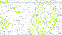
Schutzgebiete gemäss kantonalen Entscheiden
|
|

|
|
Abstract
|
Kartographie der Schutzgebiete gemäss kantonalen Entscheiden
|
|
Purpose
|
Landschaft - Biotope - und Artenschutz
|
|
Status
|
On going |
|
Sprache
|
|
Datum Erstellung
Datum Überarbeitung
|
|
|
Geobasisdaten (Bund)
|
nein |
| |
|
Identification info
|
|
Dataset URI
|
|
|
Custodian
|
Kanton Wallis
Dienststelle für Wald, Natur und Landschaft (DWNL)
Natur und Landschaft
Rue de la Dent-Blanche 18A
1950 Sion
Tel +41 27 606 32 00
sfnp@admin.vs.ch
https://www.vs.ch/de/sfnp
|
|
Topic category code
|
- L2 Natur- und Landschaftsschutz
|
|
Keyword
|
- Natürliche Lebensräume, Landschaft, Ökosysteme
- Lebensräume und Biotope
- Natürliche Pflanzen- und Tierwelt
- Naturschutzzone
|
|
Spatial representation type
|
Vector |
|
Geometric objects
|
|
|
Denominator 1:
|
| 5000 |
oder für Rasterdaten:
Distance
|
|
|
|
Reference System Information
|
CH1903+_LV95 (EPSG:2056) |
| |
|
Data quality info
|
|
Lineage
|
Kantonaler Entscheid |
|
Source
|
GIS |
| |
|
Resource constraints
|
|
Use limitation
|
Kantonale Daten |
|
Other constraints
|
- Die Geodaten sind öffentlich zugänglich. (Zugangsberechtigungsstufe A nach KGeoIG)
- Es gelten die Nutzungsbedingungen für Geodaten des Kantons Wallis (https://www.vs.ch/de/web/guest/rechtliches).
|
| |
|
Gesetzgebung
|
|
Liste
|
|
| |
|
Resource maintenance
|
|
Maintenance and update frequency
|
Continual |
|
Maintenance note
|
|
| |
|
Objektkatalog und Datenmodell
|
|
Erstellungsdatum
|
2022-04-04 |
|
Link
|
|
| |
|
Portrayal catalogue citation
|
| |
|
Distribution Information
|
|
Andere Links
|
https://sit.vs.ch/arcgis/services/Natur/MapServer/WMSServer?SERVICE=WMS&VERSION=1.3.0&REQUEST=GetCapabilities
|
|
Andere Links
|
https://sit.vs.ch/arcgis/services/Natur/MapServer/WMSServer?SERVICE=WMS&VERSION=1.3.0&REQUEST=GetCapabilities
|
|
Geoportal (Internet)
|
https://sitonline.vs.ch/nature_paysage_foret/arretes_cantonaux/#/?lang=de
|
|
Umgebung (intern)
|
S:\Geodaten VS\L2 Natur- und Landschaftsschutz\Schutzgebiete gemäss kantonalen Entscheiden.lyr |
|
Identifikator (intern)
|
97 |
|
Distributor
|
Kanton Wallis
Dienststelle für Geoinformation (DGI)
CC GEO
Rue du Scex 4
1950 Sion
Tel +41 27 606 28 00
sitvs@admin.vs.ch
https://geo.vs.ch
|
|
Distribution format
|
- ESRI Shapefile (SHP)
- OGC Web Map Service (WMS)
|
| |
|
Metadaten
|
|
File identifier
|
0aa35e0f-c661-4d35-9aee-4794e6d622d3 |
|
Date stamp
|
2025-07-28T12:00:29.905Z |
|
Metadata standard name
|
GM03 2+ |
| |