 geocat.ch
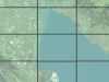
Orthofoto-Mosaik der Region Thun
Das Orthofoto-Mosaik besteht aus entzerrten Luftbildern innerhalb des Perimeters Region Thun. Die zugrunde liegenden Orthofotos wurden mit dem digitalen Geländemodell DTM-AV entzerrt. Das komprimierte Orthofoto kann mit anderen Kartenelementen, z.B. VECTOR25 oder AV-Daten überlagert werden.
Simple
- Date (Creation)
- 2005-10-06
- Date (Revision)
- 2002-04-03
- Date (Publication)
- 2026-01-22
- Identifier
- OTHUN
- Status
- Completed
Owner
Owner
Principal investigator
Principal investigator
- Topic category
-
- imageryBaseMapsEarthCover_Imagery
Extent
Extent
- Description
- Kanton Bern (reduziert) Canton de Berne (réduit)
N
S
E
W
))
- Maintenance and update frequency
- Not planned
- Keywords
-
-
Luftbild
-
Mosaik
-
Resource constraints
- Use limitation
-
Auf sämtlichen Plots und Publikationen ist der Vermerk "Orthofoto-Mosaik der Region Thun © Amt für Geoinformation des Kantons Bern; swisstopo" anzugeben.
Resource constraints
- Use constraints
- Licence End User
- Other constraints
- Die Daten sind nur zum verwaltungsinternen Gebrauch bestimmt und unterliegen den Nutzungsbestimmungen kantonaler Geodaten gemäss geltendem Vertrag. Les données ne sont destinées qu’à une utilisation interne à l’administration et sont soumises aux conditions d’utilisation applicables aux données géographiques cantonales, resp. au contrat en vigueur.
- Language
- Deutsch
- Character encoding
- UTF8
- Language
- Français
- Character encoding
- UTF8
- Language
- Italiano
- Character encoding
- UTF8
- Language
- English
- Character encoding
- UTF8
- Basic Geodata
- false
- Included with dataset
- false
Digital transfer options
- OnLine resource
-
Link zum Geoportal des Kantons Bern
- Reference system identifier
- CH1903+ / LV95 -- Swiss CH1903+ / LV95/EPSG:2056
Metadata
- Metadata identifier
- 08a66fb3-1af8-4e96-bc96-93533836b522
- Language
- Deutsch
- Character encoding
- UTF8
- Language
- Français
- Character encoding
- UTF8
Point of contact
Type of resource
- Resource scope
- Dataset
- Name
-
Geoprodukt - Géoproduit
- Date info (Creation)
- 2005-10-06T00:00:00Z
- Date info (Revision)
- 2026-01-22T00:00:00Z
Metadata standard
- Title
-
GM03 2+
)))