geocat.ch
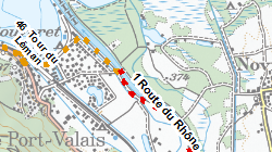
Voies cyclables principales
Voies cyclables principales de responsabilité cantonale dont l'itinéraire cycliste nationale entre Gletsch et le Bouveret
Simple
- Alternate title
-
Voies cyclables principales
- Date (Creation)
- 2018-12-07
- Identifier
- 490
- Purpose
-
Publier itinéraires cyclables cantonaux
- Status
- Completed
Custodian
- Spatial representation type
- Vector
Spatial resolution
Equivalent scale
- Denominator
- 1000
- Topic category
-
- P Transportation
Extent
Extent
- Description
-
Canton of Valais (VS)
))

- Maintenance and update frequency
- As needed
Resource format
- Title
-
ESRI Enterprise Geodatabase
- Date
- GEMET
-
-
tourism
-
- GEMET themes
-
-
transport
-
- GEMET
-
-
route
-
- geocat.ch
-
-
bike
-
opendata.swiss
-
official geodata
-
Resource constraints
- Use limitation
-
aucune
Resource constraints
- Access constraints
- Other restrictions
- Other constraints
-
Géodonnées accessibles au public (niveau A selon l'OGéo)
- Other constraints
-
Les conditions générales d'utilisation des géodonnées du Canton du Valais font foi ( https://www.vs.ch/fr/web/guest/information-legale).
Associated resource
- Association Type
- Reference from one resource to another
- Metadata Reference
- Language
- Français
- Character encoding
- UTF8
- Environment description
-
S:\Géodonnées VS\P Transport\Voies cyclables principales.lyr
- Basic Geodata
- true
- Basic Geodata ID
-
67>A.1
- Basic Geodata Legal Level
- Cantonal
- Basic Geodata Type
- basicGeodata
- Distribution format
-
-
ESRI Shapefile (SHP)
-
OGC Web Map Service (WMS)
-
ArcGIS REST Feature Service
-
Distributor
Digital transfer options
- OnLine resource
-
OpenData Valais
OpenData Valais - Site de téléchargement de géodonnées à l'Etat du Valais : multiformat et WebMercator
Digital transfer options
- OnLine resource
-
Landing Page
Landing Page pour opendata
Digital transfer options
- OnLine resource
-
Géoportail du Canton du Valais
Géoportail du Canton du Valais
Digital transfer options
- OnLine resource
-
Permalink opendata.swiss
Permalink opendata.swiss
Digital transfer options
- OnLine resource
-
2
Voies cyclables principales
Digital transfer options
- OnLine resource
-
voies_cyclables_principales
Axe cyclable cantonal
- Statement
-
TLM
- Hierarchy level
- Dataset
- Description
-
conversion (DAO)
- Geometric object type
- Curve
- Geometric object count
- 50
- Reference system identifier
- EPSG:2056/CH1903+_MN95
Metadata
- Metadata identifier
- 07ec9295-fe88-4f3b-bdcc-1adc6583a99b
- Language
- Français
- Character encoding
- UTF8
- Language
- Deutsch
- Character encoding
- UTF8
- Language
- Italiano
- Character encoding
- UTF8
- Language
- English
- Character encoding
- UTF8
- Language
- Rumantsch
- Character encoding
- UTF8
Distributor
Type of resource
- Resource scope
- Dataset
- Metadata linkage
-
https://www.geocat.ch/geonetwork/srv/api/records/07ec9295-fe88-4f3b-bdcc-1adc6583a99b
- Date info (Creation)
- 2019-02-15T09:48:14Z
- Date info (Revision)
- 2026-04-13T09:16:12.986457Z
Metadata standard
- Title
-
eCH-0271