geocat.ch
Amtliche Vermessung Kanton Schaffhausen
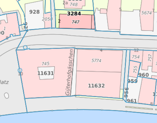
Die amtliche Vermessung (AV) liefert geometrische Daten zum Grundeigentum und ist die Grundlage für viele weitere geografische Informationen und Anwendungen in Wirtschaft, Verwaltung und Privatleben. Die Ebenen der Amtlichen Vermessung gemäss Datenmodell DM01 Version Ostschweiz (DM01AVSH48LV95) umfassen folgende Topics: FixpunkteKategorie1, FixpunkteKategorie2, FixpunkteKategorie3, Bodenbedeckung, Einzelobjekte, Hoehen, Nomenklatur, Liegenschaften, Rohrleitungen, Nummerierungsbereiche, Gemeindegrenzen, Bezirksgrenzen, Kantonsgrenzen, Landesgrenzen, Planeinteilungen, TSEinteilung, Rutschgebiete, PLZOrtschaft, Gebaeudeadressen, Planrahmen, Realisierungsstand. Offizieller Bezugsrahmen: LV95 (auf Wunsch auch LV03). Qualität: ab 2015 flächendeckend AV93. Genauigkeit: siehe Kreisschreiben AV 2010 / 06.
Simple
- Date (Revision)
- 2026-06-19
- Date (Creation)
- 2011-08-11
- Status
- On going
Point of contact
Owner
- Topic category
-
- B Location
- C Elevation
- S Farming
- P Transportation
- O Structure
- D Boundaries
- I Inland waters
- G Biota
Extent
Extent
- Description
-
Kanton Schaffhausen
))

- Maintenance and update frequency
- Continual
- Duration of Conservation
- 0
- Comment on Duration of Conservation
-
Aufbewahrungsfrist unbekannt.
- Appraisal of Archival Value
- A
- Reason for Archiving Value
- Evidence of business practice
- Keywords
-
-
AV
-
Bodenbedeckung
-
Schaffhausen
-
Liegenschaften
-
opendata.swiss
-
Grunddatzensatz
-
SH
-
DM01
-
Einzelobjekte
-
Fixpunkte
-
Amtliche Vermessung
-
Resource constraints
- Other constraints
- Freie Nutzung
Associated resource
- Association Type
- Reference to a master resource of which this one is a part
- Language
- Deutsch
- Character encoding
- UTF8
- Subtopic Category
- A2 Land Cover, Land Use
- Basic Geodata
- false
- Basic Geodata Type
- openGovernmentData
- Distribution format
-
-
DWG/DXF Geobau (SN 612 020)
-
WMS Dienst
-
WFS Dienst
-
ESRI Shapefile
-
Geopackage
-
Interlis 1 (DM01AVSH48)
-
Distributor
Digital transfer options
- OnLine resource
-
SH Datenmodell (INTERLIS)
SH Datenmodell (INTERLIS)
Digital transfer options
- OnLine resource
-
AV-WMS, CH Datenmodell, geodienste.ch
AV-WMS, CH Datenmodell, geodienste.ch
Digital transfer options
- OnLine resource
-
Kanton Schaffhausen
Kanton Schaffhausen
Digital transfer options
- OnLine resource
-
Situationsplan, CH Datenmodell, geodienste.ch
Situationsplan, CH Datenmodell, geodienste.ch
Digital transfer options
- OnLine resource
-
Situationsplan (ÖREB), CH Datenmodell, geodienste.ch
Situationsplan (ÖREB), CH Datenmodell, geodienste.ch
Digital transfer options
- OnLine resource
-
Situationsplan, CH Datenmodell, geodienste.ch
Situationsplan, CH Datenmodell, geodienste.ch
Digital transfer options
- OnLine resource
-
geodienste.ch
geodienste.ch
Digital transfer options
- OnLine resource
-
CH Datenmodell, geodienste.ch (INTERLIS, GeoPackage, Shapefile)
CH Datenmodell, geodienste.ch (INTERLIS, GeoPackage, Shapefile)
Digital transfer options
- OnLine resource
-
Situationsplan (ÖREB), CH Datenmodell, geodienste.ch
Situationsplan (ÖREB), CH Datenmodell, geodienste.ch
Digital transfer options
- OnLine resource
-
AV-WMS, CH Datenmodell, geodienste.ch
AV-WMS, CH Datenmodell, geodienste.ch
- Reference system identifier
- 2056
- Maintenance and update frequency
- Continual
Metadata
- Metadata identifier
- 04104763-8c39-4a6f-a488-be34138d304a
- Language
- Deutsch
- Character encoding
- UTF8
Point of contact
Type of resource
- Resource scope
- Dataset
- Date info (Revision)
- 2026-06-19T00:00:00
Metadata standard
- Title
-
GM03 2+